Lubao geodata
Lubao (Lomami) is a populated place; located in Democratic Republic of the Congo in Africa/Lubumbashi (GMT+2) time zone. With population of 43,068 people, there are 41 cities with bigger population in this country. Compared to other cities in Democratic Republic of the Congo, 71.4% of cities are located further ↑North; 68.6% of cities are located further ←West and 68.6% of cities have lower elevation than Lubao. Note1


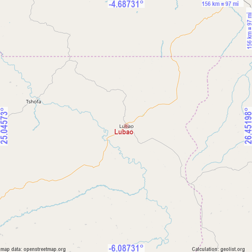
Lubao GPS coordinates[2]
5° 23' 15.756" South, 25° 44' 55.86" East
| Map corner | latitude | longitude |
|---|---|---|
| Upper-left | -4.68731°, | 25.04573° |
| Center: | -5.38771°, | 25.74885° |
| Lower-right: | -6.08731°, | 26.45198° |
| Map W x H: | 155.7×155.7 km | = 96.7×96.7mi |
| max Lat: | 4.279° ⇑71.4% North |
| Lubao: | -5.38771° |
| min Lat: | ⇓28.6% South -11.76097° |
| min Long | Lubao | max Long |
| 12.37148° | 25.74885° | 30.25224° |
| W 68.6%⇐ | ⇒31.4% E |
Elevation
Elevation of Lubao is 694 m = 2277 ft, and this is 38 m = 125 ft above average elevation for this country.
| Max E: |
1996 m = 6549 ft | 31.4% |
| Lubao | 694 m 2277 ft | |
| Avg. | 656 m = 2152 ft | |
Min E: |
11 m = 36 ft | 68.6% |
See also: Lubao elevation on elevation.city.
Geographical zone
Lubao is located in South Torrid zone (between Equator and Tropic of Capricorn). Distance of Equator is 599.1 km =372.3 mi to North.| Distance of | km | miles | from Lubao |
|---|---|---|---|
| Equator | 599.1 | 372.3 | to North |
| Tropic Capricorn | 2006.9 | 1247 | to South |
| Antarctic Circle | 6802.1 | 4226.6 | to South |
| South Pole | 9408 | 5845.9 | to South |


Nearby cities:
15 places around Lubao: (largest is in red/bold)
• Demba
385.3 km =239.4 mi,  268°
268°
• Gandajika
249.4 km =155 mi,  232°
232°
• Kabalo
148.6 km =92.3 mi,  119°
119°
• Kabinda
163.1 km =101.3 mi,  239°
239°
• Kalemie
386.3 km =240 mi,  99°
99°
• Kamina
381.3 km =236.9 mi,  192°
192°
• Kampene
223.6 km =138.9 mi,  27°
27°
• Kananga
373 km =231.8 mi,  261°
261°
• Kasongo
147.4 km =91.6 mi,  43°
43°
• Kindu
272.4 km =169.3 mi,  4°
4°
• Kongolo
138.5 km =86.1 mi,  89°
89°
• Lodja
315.9 km =196.3 mi,  311°
311°
• Lusambo
259.3 km =161.1 mi,  280°
280°
• Mbuji-Mayi
252.9 km =157.1 mi,  250°
250°
• Mwene-Ditu
311.3 km =193.4 mi, 234°
Sources, notices
• [Note1] Compared only with cities in Democratic Republic of the Congo existing in our database
• [Src1] Map data: © OpenStreetMap contributors (CC-BY-SA)
• [Src2] Other city data from geonames.org with taken over terms of usage.
• [Src3] Geographical zone / Annual Mean Temperature by Robert A. Rohde @ Wikipedia
