Demba geodata
Demba (Kasai-Central) is a populated place; located in Democratic Republic of the Congo in Africa/Lubumbashi (GMT+2) time zone. With population of 22,263 people, there are 63 cities with bigger population in this country. Compared to other cities in Democratic Republic of the Congo, 72.9% of cities are located further ↑North; 55.7% of cities are located further →East and 62.9% of cities have lower elevation than Demba. Note1


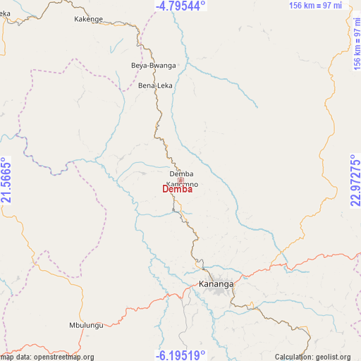
Demba GPS coordinates[2]
5° 29' 44.628" South, 22° 16' 10.632" East
| Map corner | latitude | longitude |
|---|---|---|
| Upper-left | -4.79544°, | 21.5665° |
| Center: | -5.49573°, | 22.26962° |
| Lower-right: | -6.19519°, | 22.97275° |
| Map W x H: | 155.6×155.6 km | = 96.7×96.7mi |
| max Lat: | 4.279° ⇑72.9% North |
| Demba: | -5.49573° |
| min Lat: | ⇓27.1% South -11.76097° |
| min Long | Demba | max Long |
| 12.37148° | 22.26962° | 30.25224° |
| W 44.3%⇐ | ⇒55.7% E |
Elevation
Elevation of Demba is 632 m = 2073 ft, and this is 24 m = 79 ft below average elevation for this country.
| Max E: |
1996 m = 6549 ft | 37.1% |
| Avg. | 656 m = 2152 ft | |
| Demba | 632 m = 2073 ft | |
Min E: |
11 m = 36 ft | 62.9% |
See also: Democratic Republic of the Congo elevation on elevation.city.
Geographical zone
Demba is located in South Torrid zone (between Equator and Tropic of Capricorn). Distance of Equator is 611.1 km =379.7 mi to North.| Distance of | km | miles | from Demba |
|---|---|---|---|
| Equator | 611.1 | 379.7 | to North |
| Tropic Capricorn | 1994.9 | 1239.6 | to South |
| Antarctic Circle | 6790.1 | 4219.2 | to South |
| South Pole | 9396 | 5838.4 | to South |


Nearby cities:
15 places around Demba: (largest is in red/bold)
• Bulungu
419.6 km =260.7 mi,  284°
284°
• Gandajika
232.3 km =144.3 mi,  126°
126°
• Ilebo
227 km =141.1 mi,  304°
304°
• Kabinda
254.9 km =158.4 mi,  106°
106°
• Kananga
47.4 km =29.5 mi,  159°
159°
• Kikwit
385.7 km =239.7 mi, 277°
• Lodja
264.5 km =164.4 mi,  33°
33°
• Lubao
385.3 km =239.4 mi,  88°
88°
• Luebo
95.2 km =59.2 mi, 279°
• Lusambo
142.3 km =88.4 mi,  65°
65°
• Mangai
344.5 km =214.1 mi, 298°
• Mbuji-Mayi
162.5 km =101 mi,  115°
115°
• Mweka
106.3 km =66.1 mi,  312°
312°
• Mwene-Ditu
213.1 km =132.4 mi,  142°
142°
• Tshikapa
192.1 km =119.4 mi,  237°
237°
Sources, notices
• [Note1] Compared only with cities in Democratic Republic of the Congo existing in our database
• [Src1] Map data: © OpenStreetMap contributors (CC-BY-SA)
• [Src2] Other city data from geonames.org with taken over terms of usage.
• [Src3] Geographical zone / Annual Mean Temperature by Robert A. Rohde @ Wikipedia
