Kananga geodata
Kananga (Kasai-Central) is a seat of a first-order administrative division; located in Democratic Republic of the Congo in Africa/Lubumbashi (GMT+2) time zone. With population of 463,546 people, there are 5 cities with bigger population in this country. Compared to other cities in Democratic Republic of the Congo, 77.1% of cities are located further ↑North; 54.3% of cities are located further →East and 65.7% of cities have lower elevation than Kananga. Note1


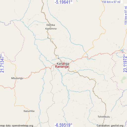
Kananga GPS coordinates[2]
5° 53' 46.464" South, 22° 24' 59.724" East
| Map corner | latitude | longitude |
|---|---|---|
| Upper-left | -5.19641°, | 21.71347° |
| Center: | -5.89624°, | 22.41659° |
| Lower-right: | -6.59519°, | 23.11972° |
| Map W x H: | 155.5×155.5 km | = 96.6×96.6mi |
| max Lat: | 4.279° ⇑77.1% North |
| Kananga: | -5.89624° |
| min Lat: | ⇓22.9% South -11.76097° |
| min Long | Kananga | max Long |
| 12.37148° | 22.41659° | 30.25224° |
| W 45.7%⇐ | ⇒54.3% E |
Elevation
Elevation of Kananga is 643 m = 2110 ft, and this is 13 m = 43 ft below average elevation for this country.
| Max E: |
1996 m = 6549 ft | 34.3% |
| Avg. | 656 m = 2152 ft | |
| Kananga | 643 m = 2110 ft | |
Min E: |
11 m = 36 ft | 65.7% |
See also: Kananga elevation on elevation.city.
Geographical zone
Kananga is located in South Torrid zone (between Equator and Tropic of Capricorn). Distance of Equator is 655.6 km =407.4 mi to North.| Distance of | km | miles | from Kananga |
|---|---|---|---|
| Equator | 655.6 | 407.4 | to North |
| Tropic Capricorn | 1950.3 | 1211.9 | to South |
| Antarctic Circle | 6745.6 | 4191.5 | to South |
| South Pole | 9351.5 | 5810.8 | to South |


Nearby cities:
15 places around Kananga: (largest is in red/bold)
• Demba
47.4 km =29.5 mi,  339°
339°
• Gandajika
194.3 km =120.7 mi,  119°
119°
• Ilebo
267.1 km =166 mi,  310°
310°
• Kabinda
229.9 km =142.9 mi,  96°
96°
• Kamina
425 km =264.1 mi,  137°
137°
• Kikwit
409.7 km =254.6 mi,  283°
283°
• Lodja
294.9 km =183.2 mi,  26°
26°
• Lubao
373 km =231.8 mi,  81°
81°
• Luebo
125.6 km =78 mi,  298°
298°
• Lusambo
153 km =95.1 mi,  47°
47°
• Mangai
381.2 km =236.9 mi, 303°
• Mbuji-Mayi
132.4 km =82.3 mi, 101°
• Mweka
150 km =93.2 mi,  320°
320°
• Mwene-Ditu
168.6 km =104.8 mi, 137°
• Tshikapa
187.8 km =116.7 mi,  252°
252°
Sources, notices
• [Note1] Compared only with cities in Democratic Republic of the Congo existing in our database
• [Src1] Map data: © OpenStreetMap contributors (CC-BY-SA)
• [Src2] Other city data from geonames.org with taken over terms of usage.
• [Src3] Geographical zone / Annual Mean Temperature by Robert A. Rohde @ Wikipedia
