Kabinda geodata
Kabinda (Kasaï-Oriental) is a populated place; located in Democratic Republic of the Congo in Africa/Lubumbashi (GMT+2) time zone. With population of 59,004 people, there are 33 cities with bigger population in this country. Compared to other cities in Democratic Republic of the Congo, 84.3% of cities are located further ↑North; 61.4% of cities are located further ←West and 78.6% of cities have lower elevation than Kabinda. Note1


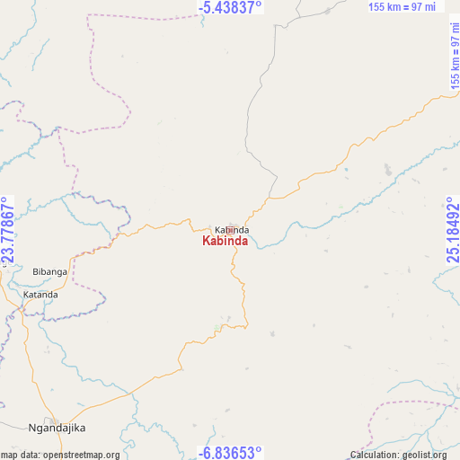
Kabinda GPS coordinates[2]
6° 8' 16.476" South, 24° 28' 54.444" East
| Map corner | latitude | longitude |
|---|---|---|
| Upper-left | -5.43837°, | 23.77867° |
| Center: | -6.13791°, | 24.48179° |
| Lower-right: | -6.83653°, | 25.18492° |
| Map W x H: | 155.5×155.5 km | = 96.6×96.6mi |
| max Lat: | 4.279° ⇑84.3% North |
| Kabinda: | -6.13791° |
| min Lat: | ⇓15.7% South -11.76097° |
| min Long | Kabinda | max Long |
| 12.37148° | 24.48179° | 30.25224° |
| W 61.4%⇐ | ⇒38.6% E |
Elevation
Elevation of Kabinda is 884 m = 2900 ft, and this is 228 m = 748 ft above average elevation for this country.
| Max E: |
1996 m = 6549 ft | 21.4% |
| Kabinda | 884 m 2900 ft | |
| Avg. | 656 m = 2152 ft | |
Min E: |
11 m = 36 ft | 78.6% |
See also: Kabinda elevation on elevation.city.
Geographical zone
Kabinda is located in South Torrid zone (between Equator and Tropic of Capricorn). Distance of Equator is 682.5 km =424.1 mi to North.| Distance of | km | miles | from Kabinda |
|---|---|---|---|
| Equator | 682.5 | 424.1 | to North |
| Tropic Capricorn | 1923.4 | 1195.1 | to South |
| Antarctic Circle | 6718.7 | 4174.8 | to South |
| South Pole | 9324.6 | 5794 | to South |


Nearby cities:
15 places around Kabinda: (largest is in red/bold)
• Demba
254.9 km =158.4 mi,  286°
286°
• Gandajika
89.3 km =55.5 mi,  220°
220°
• Kabalo
269.1 km =167.2 mi,  87°
87°
• Kamina
294.3 km =182.9 mi,  168°
168°
• Kampene
372.1 km =231.2 mi,  40°
40°
• Kananga
229.9 km =142.9 mi,  276°
276°
• Kasongo
307.7 km =191.2 mi,  51°
51°
• Kongolo
290.9 km =180.8 mi,  73°
73°
• Lodja
306.9 km =190.7 mi,  341°
341°
• Lubao
163.1 km =101.3 mi,  59°
59°
• Luebo
349.6 km =217.2 mi, 284°
• Lusambo
172.9 km =107.4 mi,  318°
318°
• Mbuji-Mayi
98.6 km =61.3 mi,  270°
270°
• Mweka
353.6 km =219.7 mi, 293°
• Mwene-Ditu
149.3 km =92.8 mi,  229°
229°
Sources, notices
• [Note1] Compared only with cities in Democratic Republic of the Congo existing in our database
• [Src1] Map data: © OpenStreetMap contributors (CC-BY-SA)
• [Src2] Other city data from geonames.org with taken over terms of usage.
• [Src3] Geographical zone / Annual Mean Temperature by Robert A. Rohde @ Wikipedia
