Bouca geodata
Bouca (Ouham) is a populated place; located in Central African Republic in Africa/Bangui (GMT+1) time zone. With population of 13,250 people, there are 23 cities with bigger population in this country. Compared to other cities in Central African Republic, 77.1% of cities are located further ↓South; 65.7% of cities are located further →East and 57.1% of cities have higher elevation than Bouca. Note1


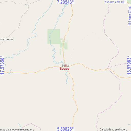
Bouca GPS coordinates[2]
6° 30' 26.424" North, 18° 16' 36.12" East
| Map corner | latitude | longitude |
|---|---|---|
| Upper-left | 7.20543°, | 17.57358° |
| Center: | 6.50734°, | 18.2767° |
| Lower-right: | 5.80828°, | 18.97983° |
| Map W x H: | 155.3×155.4 km | = 96.5×96.6mi |
| max Lat: | 10.28488° ⇑22.9% North |
| Bouca: | 6.50734° |
| min Lat: | ⇓77.1% South 3.52494° |
| min Long | Bouca | max Long |
| 15.13926° | 18.2767° | 26.49211° |
| W 34.3%⇐ | ⇒65.7% E |
Elevation
Elevation of Bouca is 463 m = 1519 ft, and this is 42.3 m = 139 ft below average elevation for this country.
| Max E: |
976 m = 3202 ft | 57.1% |
| Avg. | 505.3 m = 1658 ft | |
| Bouca | 463 m = 1519 ft | |
Min E: |
351 m = 1152 ft | 42.9% |
See also: Central African Republic elevation on elevation.city.
Geographical zone
Bouca is located in North Torrid zone (between Equator and Tropic of Cancer). Distance of Equator is 723.5 km =449.6 mi to South.| Distance of | km | miles | from Bouca |
|---|---|---|---|
| North Pole | 9283.5 | 5768.5 | to North |
| Arctic Circle | 6677.6 | 4149.3 | to North |
| Tropic Cancer | 1882.4 | 1169.7 | to North |
| Equator | 723.5 | 449.6 | to South |


Nearby cities:
15 places around Bouca: (largest is in red/bold)
• Bambari
277.7 km =172.6 mi,  107°
107°
• Bangui
240.6 km =149.5 mi,  172°
172°
• Baoro
272 km =169 mi,  249°
249°
• Batangafo
88.2 km =54.8 mi,  0°
0°
• Bimbo
250.7 km =155.8 mi,  176°
176°
• Boali
190.5 km =118.4 mi, 184°
• Boda
259.2 km =161.1 mi,  200°
200°
• Bossangoa
90.8 km =56.4 mi,  268°
268°
• Bozoum
210.6 km =130.9 mi,  264°
264°
• Damara
178.3 km =110.8 mi,  164°
164°
• Kabo
138.1 km =85.8 mi,  16°
16°
• Kaga Bandoro
114 km =70.8 mi,  61°
61°
• Kouango
251.2 km =156.1 mi,  132°
132°
• Paoua
218.6 km =135.8 mi,  291°
291°
• Sibut
124.4 km =77.3 mi, 134°
Sources, notices
• [Note1] Compared only with cities in Central African Republic existing in our database
• [Src1] Map data: © OpenStreetMap contributors (CC-BY-SA)
• [Src2] Other city data from geonames.org with taken over terms of usage.
• [Src3] Geographical zone / Annual Mean Temperature by Robert A. Rohde @ Wikipedia
