Kabo geodata
Kabo (Ouham) is a populated place; located in Central African Republic in Africa/Bangui (GMT+1) time zone. With population of 13,637 people, there are 22 cities with bigger population in this country. Compared to other cities in Central African Republic, 91.4% of cities are located further ↓South; 51.4% of cities are located further →East and 71.4% of cities have higher elevation than Kabo. Note1


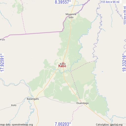
Kabo GPS coordinates[2]
7° 41' 57.732" North, 18° 37' 44.508" East
| Map corner | latitude | longitude |
|---|---|---|
| Upper-left | 8.39557°, | 17.92591° |
| Center: | 7.69937°, | 18.62903° |
| Lower-right: | 7.00203°, | 19.33216° |
| Map W x H: | 154.9×155 km | = 96.3×96.3mi |
| max Lat: | 10.28488° ⇑8.6% North |
| Kabo: | 7.69937° |
| min Lat: | ⇓91.4% South 3.52494° |
| min Long | Kabo | max Long |
| 15.13926° | 18.62903° | 26.49211° |
| W 48.6%⇐ | ⇒51.4% E |
Elevation
Elevation of Kabo is 418 m = 1371 ft, and this is 87.3 m = 286 ft below average elevation for this country.
| Max E: |
976 m = 3202 ft | 71.4% |
| Avg. | 505.3 m = 1658 ft | |
| Kabo | 418 m = 1371 ft | |
Min E: |
351 m = 1152 ft | 28.6% |
See also: Central African Republic elevation on elevation.city.
Geographical zone
Kabo is located in North Torrid zone (between Equator and Tropic of Cancer). Distance of Equator is 856.1 km =532 mi to South.| Distance of | km | miles | from Kabo |
|---|---|---|---|
| North Pole | 9151 | 5686.2 | to North |
| Arctic Circle | 6545.1 | 4066.9 | to North |
| Tropic Cancer | 1749.8 | 1087.3 | to North |
| Equator | 856.1 | 532 | to South |


Nearby cities:
15 places around Kabo: (largest is in red/bold)
• Bambari
311.7 km =193.7 mi,  133°
133°
• Bangui
371.3 km =230.7 mi,  181°
181°
• Baoro
370.8 km =230.4 mi,  232°
232°
• Batangafo
58.4 km =36.3 mi,  220°
220°
• Boali
327.1 km =203.3 mi,  189°
189°
• Bossangoa
186.5 km =115.9 mi, 223°
• Bouca
138.1 km =85.8 mi,  196°
196°
• Bozoum
291.8 km =181.3 mi,  238°
238°
• Damara
304.6 km =189.3 mi, 178°
• Ippy
327.7 km =203.6 mi,  119°
119°
• Kaga Bandoro
100.1 km =62.2 mi,  142°
142°
• Kouango
335 km =208.2 mi,  153°
153°
• Ndélé
235.9 km =146.6 mi,  70°
70°
• Paoua
246.6 km =153.2 mi,  258°
258°
• Sibut
225.7 km =140.2 mi,  167°
167°
Sources, notices
• [Note1] Compared only with cities in Central African Republic existing in our database
• [Src1] Map data: © OpenStreetMap contributors (CC-BY-SA)
• [Src2] Other city data from geonames.org with taken over terms of usage.
• [Src3] Geographical zone / Annual Mean Temperature by Robert A. Rohde @ Wikipedia
