Paoua geodata
Paoua (Ouham-Pendé) is a populated place; located in Central African Republic in Africa/Bangui (GMT+1) time zone. With population of 18,441 people, there are 16 cities with bigger population in this country. Compared to other cities in Central African Republic, 85.7% of cities are located further ↓South; 80% of cities are located further →East and 85.7% of cities have lower elevation than Paoua. Note1


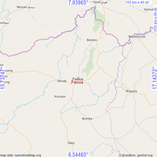
Paoua GPS coordinates[2]
7° 14' 33.684" North, 16° 26' 26.124" East
| Map corner | latitude | longitude |
|---|---|---|
| Upper-left | 7.93965°, | 15.73747° |
| Center: | 7.24269°, | 16.44059° |
| Lower-right: | 6.54465°, | 17.14372° |
| Map W x H: | 155.1×155.1 km | = 96.4×96.4mi |
| max Lat: | 10.28488° ⇑14.3% North |
| Paoua: | 7.24269° |
| min Lat: | ⇓85.7% South 3.52494° |
| min Long | Paoua | max Long |
| 15.13926° | 16.44059° | 26.49211° |
| W 20%⇐ | ⇒80% E |
Elevation
Elevation of Paoua is 601 m = 1972 ft, and this is 95.7 m = 314 ft above average elevation for this country.
| Max E: |
976 m = 3202 ft | 14.3% |
| Paoua | 601 m 1972 ft | |
| Avg. | 505.3 m = 1658 ft | |
Min E: |
351 m = 1152 ft | 85.7% |
See also: Central African Republic elevation on elevation.city.
Geographical zone
Paoua is located in North Torrid zone (between Equator and Tropic of Cancer). Distance of Equator is 805.3 km =500.4 mi to South.| Distance of | km | miles | from Paoua |
|---|---|---|---|
| North Pole | 9201.8 | 5717.7 | to North |
| Arctic Circle | 6595.9 | 4098.5 | to North |
| Tropic Cancer | 1800.6 | 1118.8 | to North |
| Equator | 805.3 | 500.4 | to South |


Nearby cities:
15 places around Paoua: (largest is in red/bold)
• Baoro
182.9 km =113.6 mi,  196°
196°
• Batangafo
203.3 km =126.3 mi,  88°
88°
• Berbérati
339.2 km =210.8 mi,  192°
192°
• Boali
329.4 km =204.7 mi,  145°
145°
• Boda
344.4 km =214 mi,  160°
160°
• Bossangoa
139.6 km =86.7 mi,  126°
126°
• Bouar
172.8 km =107.4 mi,  212°
212°
• Bouca
218.6 km =135.8 mi,  111°
111°
• Bozoum
102.9 km =63.9 mi,  183°
183°
• Carnot
263.2 km =163.5 mi, 193°
• Damara
356.3 km =221.4 mi,  135°
135°
• Gamboula
376.1 km =233.7 mi, 202°
• Kabo
246.6 km =153.2 mi,  78°
78°
• Kaga Bandoro
304.4 km =189.1 mi,  95°
95°
• Sibut
336.7 km =209.2 mi,  120°
120°
Sources, notices
• [Note1] Compared only with cities in Central African Republic existing in our database
• [Src1] Map data: © OpenStreetMap contributors (CC-BY-SA)
• [Src2] Other city data from geonames.org with taken over terms of usage.
• [Src3] Geographical zone / Annual Mean Temperature by Robert A. Rohde @ Wikipedia
