Bozoum geodata
Bozoum (Ouham-Pendé) is a seat of a first-order administrative division; located in Central African Republic in Africa/Bangui (GMT+1) time zone. With population of 40,201 people, there are 5 cities with bigger population in this country. Compared to other cities in Central African Republic, 71.4% of cities are located further ↓South; 82.9% of cities are located further →East and 91.4% of cities have lower elevation than Bozoum. Note1


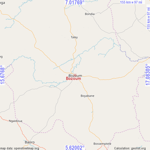
Bozoum GPS coordinates[2]
6° 19' 9.588" North, 16° 22' 47.712" East
| Map corner | latitude | longitude |
|---|---|---|
| Upper-left | 7.01769°, | 15.6768° |
| Center: | 6.31933°, | 16.37992° |
| Lower-right: | 5.62002°, | 17.08305° |
| Map W x H: | 155.4×155.4 km | = 96.6×96.6mi |
| max Lat: | 10.28488° ⇑28.6% North |
| Bozoum: | 6.31933° |
| min Lat: | ⇓71.4% South 3.52494° |
| min Long | Bozoum | max Long |
| 15.13926° | 16.37992° | 26.49211° |
| W 17.1%⇐ | ⇒82.9% E |
Elevation
Elevation of Bozoum is 664 m = 2178 ft, and this is 158.7 m = 521 ft above average elevation for this country.
| Max E: |
976 m = 3202 ft | 8.6% |
| Bozoum | 664 m 2178 ft | |
| Avg. | 505.3 m = 1658 ft | |
Min E: |
351 m = 1152 ft | 91.4% |
See also: Bozoum elevation on elevation.city.
Geographical zone
Bozoum is located in North Torrid zone (between Equator and Tropic of Cancer). Distance of Equator is 702.6 km =436.6 mi to South.| Distance of | km | miles | from Bozoum |
|---|---|---|---|
| North Pole | 9304.4 | 5781.5 | to North |
| Arctic Circle | 6698.5 | 4162.3 | to North |
| Tropic Cancer | 1903.3 | 1182.7 | to North |
| Equator | 702.6 | 436.6 | to South |


Nearby cities:
15 places around Bozoum: (largest is in red/bold)
• Baoro
85.8 km =53.3 mi,  212°
212°
• Batangafo
236.8 km =147.1 mi,  62°
62°
• Berbérati
237.9 km =147.8 mi,  195°
195°
• Boali
256.7 km =159.5 mi,  131°
131°
• Boda
253 km =157.2 mi,  151°
151°
• Bossangoa
120.4 km =74.8 mi,  80°
80°
• Bouar
96.7 km =60.1 mi,  243°
243°
• Bouca
210.6 km =130.9 mi, 84°
• Carnot
162.9 km =101.2 mi, 199°
• Damara
298.2 km =185.3 mi,  120°
120°
• Gamboula
280.7 km =174.4 mi, 209°
• Kabo
291.8 km =181.3 mi, 58°
• Nola
312.9 km =194.4 mi,  186°
186°
• Paoua
102.9 km =63.9 mi,  3°
3°
• Sibut
305.3 km =189.7 mi,  102°
102°
Sources, notices
• [Note1] Compared only with cities in Central African Republic existing in our database
• [Src1] Map data: © OpenStreetMap contributors (CC-BY-SA)
• [Src2] Other city data from geonames.org with taken over terms of usage.
• [Src3] Geographical zone / Annual Mean Temperature by Robert A. Rohde @ Wikipedia
