Batangafo geodata
Batangafo (Ouham) is a populated place; located in Central African Republic in Africa/Bangui (GMT+1) time zone. With population of 15,310 people, there are 19 cities with bigger population in this country. Compared to other cities in Central African Republic, 88.6% of cities are located further ↓South; 62.9% of cities are located further →East and 68.6% of cities have higher elevation than Batangafo. Note1


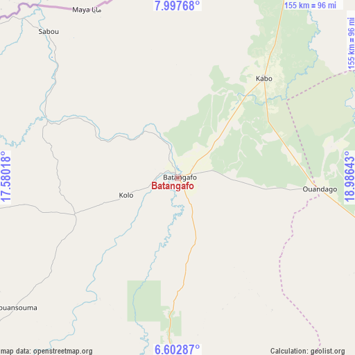
Batangafo GPS coordinates[2]
7° 18' 2.952" North, 18° 16' 59.88" East
| Map corner | latitude | longitude |
|---|---|---|
| Upper-left | 7.99768°, | 17.58018° |
| Center: | 7.30082°, | 18.2833° |
| Lower-right: | 6.60287°, | 18.98643° |
| Map W x H: | 155.1×155.1 km | = 96.4×96.4mi |
| max Lat: | 10.28488° ⇑11.4% North |
| Batangafo: | 7.30082° |
| min Lat: | ⇓88.6% South 3.52494° |
| min Long | Batangafo | max Long |
| 15.13926° | 18.2833° | 26.49211° |
| W 37.1%⇐ | ⇒62.9% E |
Elevation
Elevation of Batangafo is 425 m = 1394 ft, and this is 80.3 m = 263 ft below average elevation for this country.
| Max E: |
976 m = 3202 ft | 68.6% |
| Avg. | 505.3 m = 1658 ft | |
| Batangafo | 425 m = 1394 ft | |
Min E: |
351 m = 1152 ft | 31.4% |
See also: Central African Republic elevation on elevation.city.
Geographical zone
Batangafo is located in North Torrid zone (between Equator and Tropic of Cancer). Distance of Equator is 811.8 km =504.4 mi to South.| Distance of | km | miles | from Batangafo |
|---|---|---|---|
| North Pole | 9195.3 | 5713.7 | to North |
| Arctic Circle | 6589.4 | 4094.5 | to North |
| Tropic Cancer | 1794.1 | 1114.8 | to North |
| Equator | 811.8 | 504.4 | to South |


Nearby cities:
15 places around Batangafo: (largest is in red/bold)
• Bambari
314.5 km =195.4 mi,  122°
122°
• Bangui
328.2 km =203.9 mi,  174°
174°
• Baoro
313.9 km =195 mi,  234°
234°
• Boali
278.5 km =173.1 mi,  183°
183°
• Bossangoa
128.2 km =79.7 mi, 225°
• Bouar
333.4 km =207.2 mi,  242°
242°
• Bouca
88.2 km =54.8 mi, 180°
• Bozoum
236.8 km =147.1 mi, 242°
• Damara
264.3 km =164.2 mi, 169°
• Kabo
58.4 km =36.3 mi,  40°
40°
• Kaga Bandoro
105.6 km =65.6 mi,  109°
109°
• Kouango
316.6 km =196.7 mi,  144°
144°
• Ndélé
288.2 km =179.1 mi,  64°
64°
• Paoua
203.3 km =126.3 mi,  268°
268°
• Sibut
196.5 km =122.1 mi,  153°
153°
Sources, notices
• [Note1] Compared only with cities in Central African Republic existing in our database
• [Src1] Map data: © OpenStreetMap contributors (CC-BY-SA)
• [Src2] Other city data from geonames.org with taken over terms of usage.
• [Src3] Geographical zone / Annual Mean Temperature by Robert A. Rohde @ Wikipedia
