Boda geodata
Boda (Lobaye) is a populated place; located in Central African Republic in Africa/Bangui (GMT+1) time zone. With population of 16,655 people, there are 17 cities with bigger population in this country. Compared to other cities in Central African Republic, 80% of cities are located further ↑North; 74.3% of cities are located further →East and 62.9% of cities have lower elevation than Boda. Note1


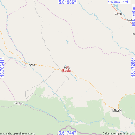
Boda GPS coordinates[2]
4° 19' 7.932" North, 17° 28' 10.308" East
| Map corner | latitude | longitude |
|---|---|---|
| Upper-left | 5.01966°, | 16.76641° |
| Center: | 4.31887°, | 17.46953° |
| Lower-right: | 3.61744°, | 18.17266° |
| Map W x H: | 155.9×155.9 km | = 96.9×96.9mi |
| max Lat: | 10.28488° ⇑80% North |
| Boda: | 4.31887° |
| min Lat: | ⇓20% South 3.52494° |
| min Long | Boda | max Long |
| 15.13926° | 17.46953° | 26.49211° |
| W 25.7%⇐ | ⇒74.3% E |
Elevation
Elevation of Boda is 507 m = 1663 ft, and this is 1.7 m = 6 ft above average elevation for this country.
| Max E: |
976 m = 3202 ft | 37.1% |
| Boda | 507 m 1663 ft | |
| Avg. | 505.3 m = 1658 ft | |
Min E: |
351 m = 1152 ft | 62.9% |
See also: Central African Republic elevation on elevation.city.
Geographical zone
Boda is located in North Torrid zone (between Equator and Tropic of Cancer). Distance of Equator is 480.2 km =298.4 mi to South.| Distance of | km | miles | from Boda |
|---|---|---|---|
| North Pole | 9526.8 | 5919.7 | to North |
| Arctic Circle | 6921 | 4300.5 | to North |
| Tropic Cancer | 2125.7 | 1320.8 | to North |
| Equator | 480.2 | 298.4 | to South |


Nearby cities:
15 places around Boda: (largest is in red/bold)
• Bangui
120.4 km =74.8 mi,  87°
87°
• Baoro
224 km =139.2 mi,  311°
311°
• Berbérati
186.1 km =115.6 mi,  268°
268°
• Bimbo
105.2 km =65.4 mi, 93°
• Boali
90.5 km =56.2 mi,  53°
53°
• Bossangoa
241.7 km =150.2 mi,  359°
359°
• Bouca
259.2 km =161.1 mi,  20°
20°
• Bozoum
253 km =157.2 mi,  331°
331°
• Carnot
189.6 km =117.8 mi,  291°
291°
• Damara
154.3 km =95.9 mi,  62°
62°
• Gamboula
259.4 km =161.2 mi, 265°
• Mbaïki
76.4 km =47.5 mi,  131°
131°
• Mongoumba
145.7 km =90.5 mi,  121°
121°
• Nola
180.9 km =112.4 mi,  240°
240°
• Sibut
236.2 km =146.8 mi, 48°
Sources, notices
• [Note1] Compared only with cities in Central African Republic existing in our database
• [Src1] Map data: © OpenStreetMap contributors (CC-BY-SA)
• [Src2] Other city data from geonames.org with taken over terms of usage.
• [Src3] Geographical zone / Annual Mean Temperature by Robert A. Rohde @ Wikipedia
