Bouar geodata
Bouar (Nana-Mambéré) is a seat of a first-order administrative division; located in Central African Republic in Africa/Bangui (GMT+1) time zone. With population of 28,581 people, there are 10 cities with bigger population in this country. Compared to other cities in Central African Republic, 65.7% of cities are located further ↓South; 97.1% of cities are located further →East and 100% of cities have lower elevation than Bouar. Note1


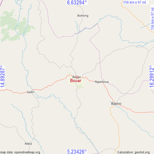
Bouar GPS coordinates[2]
5° 56' 2.544" North, 15° 35' 45.564" East
| Map corner | latitude | longitude |
|---|---|---|
| Upper-left | 6.63294°, | 14.89287° |
| Center: | 5.93404°, | 15.59599° |
| Lower-right: | 5.23426°, | 16.29912° |
| Map W x H: | 155.5×155.5 km | = 96.6×96.6mi |
| max Lat: | 10.28488° ⇑34.3% North |
| Bouar: | 5.93404° |
| min Lat: | ⇓65.7% South 3.52494° |
| min Long | Bouar | max Long |
| 15.13926° | 15.59599° | 26.49211° |
| W 2.9%⇐ | ⇒97.1% E |
Elevation
Elevation of Bouar is 976 m = 3202 ft, and this is 470.7 m = 1544 ft above average elevation for this country.
| Max E: |
976 m = 3202 ft | 0% |
| Bouar | 976 m 3202 ft | |
| Avg. | 505.3 m = 1658 ft | |
Min E: |
351 m = 1152 ft | 100% |
See also: Central African Republic elevation on elevation.city.
Geographical zone
Bouar is located in North Torrid zone (between Equator and Tropic of Cancer). Distance of Equator is 659.8 km =410 mi to South.| Distance of | km | miles | from Bouar |
|---|---|---|---|
| North Pole | 9347.3 | 5808.1 | to North |
| Arctic Circle | 6741.4 | 4188.9 | to North |
| Tropic Cancer | 1946.1 | 1209.3 | to North |
| Equator | 659.8 | 410 | to South |


Nearby cities:
15 places around Bouar: (largest is in red/bold)
• Baoro
50.6 km =31.4 mi,  125°
125°
• Batangafo
333.4 km =207.2 mi,  62°
62°
• Berbérati
187.3 km =116.4 mi,  173°
173°
• Bimbo
363.7 km =226 mi,  120°
120°
• Boali
307.3 km =190.9 mi,  114°
114°
• Boda
274.4 km =170.5 mi, 130°
• Bossangoa
214.7 km =133.4 mi,  73°
73°
• Bouca
303.1 km =188.3 mi,  77°
77°
• Bozoum
96.7 km =60.1 mi, 63°
• Carnot
114.5 km =71.1 mi,  164°
164°
• Damara
360.6 km =224.1 mi, 107°
• Gamboula
208.2 km =129.4 mi,  194°
194°
• Mbaïki
350.8 km =218 mi, 130°
• Nola
272.5 km =169.3 mi, 169°
• Paoua
172.8 km =107.4 mi,  32°
32°
Sources, notices
• [Note1] Compared only with cities in Central African Republic existing in our database
• [Src1] Map data: © OpenStreetMap contributors (CC-BY-SA)
• [Src2] Other city data from geonames.org with taken over terms of usage.
• [Src3] Geographical zone / Annual Mean Temperature by Robert A. Rohde @ Wikipedia
