Sassandra geodata
Sassandra (Bas-Sassandra) is a populated place; located in Ivory Coast in Africa/Abidjan (GMT+0) time zone. With population of 23,274 people, there are 47 cities with bigger population in this country. Compared to other cities in Ivory Coast, 98.3% of cities are located further ↑North; 65.8% of cities are located further →East and 88.9% of cities have higher elevation than Sassandra. Note1


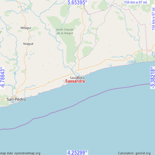
Sassandra GPS coordinates[2]
4° 57' 13.824" North, 6° 5' 7.116" West
| Map corner | latitude | longitude |
|---|---|---|
| Upper-left | 5.65395°, | -6.78843° |
| Center: | 4.95384°, | -6.08531° |
| Lower-right: | 4.25299°, | -5.38218° |
| Map W x H: | 155.8×155.8 km | = 96.8×96.8mi |
| max Lat: | 10.48115° ⇑98.3% North |
| Sassandra: | 4.95384° |
| min Lat: | ⇓1.7% South 4.42295° |
| min Long | Sassandra | max Long |
| -8.42592° | -6.08531° | -2.80003° |
| W 34.2%⇐ | ⇒65.8% E |
Elevation
Elevation of Sassandra is 38 m = 125 ft, and this is 186.3 m = 611 ft below average elevation for this country.
| Max E: |
556 m = 1824 ft | 88.9% |
| Avg. | 224.3 m = 736 ft | |
| Sassandra | 38 m = 125 ft | |
Min E: |
7 m = 23 ft | 11.1% |
See also: Ivory Coast elevation on elevation.city.
Geographical zone
Sassandra is located in North Torrid zone (between Equator and Tropic of Cancer). Distance of Equator is 550.8 km =342.3 mi to South.| Distance of | km | miles | from Sassandra |
|---|---|---|---|
| North Pole | 9456.2 | 5875.8 | to North |
| Arctic Circle | 6850.4 | 4256.6 | to North |
| Tropic Cancer | 2055.1 | 1277 | to North |
| Equator | 550.8 | 342.3 | to South |


Nearby cities:
15 places around Sassandra: (largest is in red/bold)
• Buyo
178.2 km =110.7 mi,  325°
325°
• Divo
127.1 km =79 mi,  39°
39°
• Fresco
58.9 km =36.6 mi,  75°
75°
• Gagnoa
131.8 km =81.9 mi,  6°
6°
• Grand-Lahou
124.3 km =77.2 mi,  74°
74°
• Guibéroua
143.2 km =89 mi,  356°
356°
• Guitry
112.7 km =70 mi,  56°
56°
• Guéyo
81.7 km =50.8 mi,  1°
1°
• Lakota
108.9 km =67.7 mi,  24°
24°
• Oumé
175.3 km =108.9 mi, 24°
• San-Pédro
65.2 km =40.5 mi,  249°
249°
• Soubré
108.1 km =67.2 mi, 328°
• Taabo
175.7 km =109.2 mi, 37°
• Tabou
152.4 km =94.7 mi, 247°
• Tiassalé
174.8 km =108.6 mi,  53°
53°
Sources, notices
• [Note1] Compared only with cities in Ivory Coast existing in our database
• [Src1] Map data: © OpenStreetMap contributors (CC-BY-SA)
• [Src2] Other city data from geonames.org with taken over terms of usage.
• [Src3] Geographical zone / Annual Mean Temperature by Robert A. Rohde @ Wikipedia
