Changqing geodata
Changqing (Shandong) is a populated place; located in China in Asia/Shanghai (GMT+8) time zone. With population of 82,598 people, there are 515 cities with bigger population in this country. Compared to other cities in China, 78.4% of cities are located further ↓South; 64.5% of cities are located further ←West and 74.1% of cities have higher elevation than Changqing. Note1


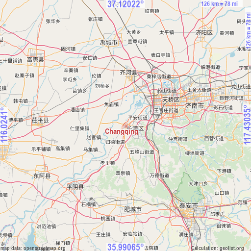
Changqing GPS coordinates[2]
36° 33' 27" North, 116° 43' 37.992" East
| Map corner | latitude | longitude |
|---|---|---|
| Upper-left | 37.12022°, | 116.0241° |
| Center: | 36.5575°, | 116.72722° |
| Lower-right: | 35.99065°, | 117.43035° |
| Map W x H: | 125.6×125.6 km | = 78×78mi |
| max Lat: | 53.31946° ⇑21.6% North |
| Changqing: | 36.5575° |
| min Lat: | ⇓78.4% South 18.22056° |
| min Long | Changqing | max Long |
| 75.07348° | 116.72722° | 134.28917° |
| W 64.5%⇐ | ⇒35.5% E |
Elevation
Elevation of Changqing is 39 m = 128 ft, and this is 445.8 m = 1463 ft below average elevation for this country.
| Max E: |
5622 m = 18445 ft | 74.1% |
| Avg. | 484.8 m = 1591 ft | |
| Changqing | 39 m = 128 ft | |
Min E: |
-3 m = -10 ft | 25.9% |
See also: Changqing elevation on elevation.city.
Geographical zone
Changqing is located in North temperate zone (between Tropic of Cancer and the Arctic Circle). Distance of this Northern Tropic circle is 1458.9 km =906.5 mi to South.| Distance of | km | miles | from Changqing |
|---|---|---|---|
| North Pole | 5942.2 | 3692.3 | to North |
| Arctic Circle | 3336.4 | 2073.1 | to North |
| Tropic Cancer | 1458.9 | 906.5 | to South |
| Equator | 4064.8 | 2525.7 | to South |


Nearby cities:
15 places around Changqing: (largest is in red/bold)
• Feicheng
34.5 km =21.4 mi,  174°
174°
• Gulou
69.4 km =43.1 mi,  259°
259°
• Jinan
27.1 km =16.8 mi,  62°
62°
• Laiwu
92.6 km =57.5 mi,  115°
115°
• Liaocheng
67.9 km =42.2 mi, 260°
• Lingcheng
87.2 km =54.2 mi,  350°
350°
• Mingshui
71.2 km =44.2 mi,  75°
75°
• Nancheng
78.2 km =48.6 mi,  303°
303°
• Ningyang
88.4 km =54.9 mi,  176°
176°
• Pingyin
39.6 km =24.6 mi,  219°
219°
• Tai’an
54.3 km =33.7 mi,  139°
139°
• Wenshang
94.6 km =58.8 mi,  192°
192°
• Xiliguantun
90.8 km =56.4 mi,  309°
309°
• Yancheng
26.9 km =16.7 mi,  3°
3°
• Zhoucheng
80.9 km =50.3 mi,  207°
207°
Sources, notices
• [Note1] Compared only with cities in China existing in our database
• [Src1] Map data: © OpenStreetMap contributors (CC-BY-SA)
• [Src2] Other city data from geonames.org with taken over terms of usage.
• [Src3] Geographical zone / Annual Mean Temperature by Robert A. Rohde @ Wikipedia
