Rongdoi geodata
Rongdoi (Tibet) is a seat of a fourth-order administrative division; located in China in Asia/Shanghai (GMT+8) time zone. In our database, there are 1268 cities with bigger population. Compared to other cities in China, 50.1% of cities are located further ↑North; 96.8% of cities are located further →East and 99.4% of cities have lower elevation than Rongdoi. Note1


Rongdoi GPS coordinates[2]
30° 26' 26.736" North, 92° 2' 57.264" East
| Map corner | latitude | longitude |
|---|---|---|
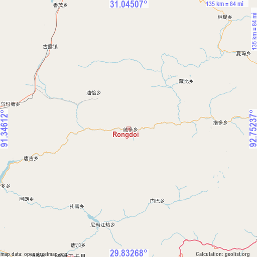
| Upper-left | 31.04507°, | 91.34612° |
| Center: | 30.44076°, | 92.04924° |
| Lower-right: | 29.83268°, | 92.75237° |
| Map W x H: | 134.8×134.8 km | = 83.8×83.8mi |
| max Lat: | 53.31946° ⇑50.1% North |
| Rongdoi: | 30.44076° |
| min Lat: | ⇓49.9% South 18.22056° |
| min Long | Rongdoi | max Long |
| 75.07348° | 92.04924° | 134.28917° |
| W 3.2%⇐ | ⇒96.8% E |
Elevation
Elevation of Rongdoi is 4379 m = 14367 ft, and this is 3894.2 m = 12776 ft above average elevation for this country.
| Max E: |
5622 m = 18445 ft | 0.59999999999999% |
| Rongdoi | 4379 m 14367 ft | |
| Avg. | 484.8 m = 1591 ft | |
Min E: |
-3 m = -10 ft | 99.4% |
See also: China elevation on elevation.city.
Geographical zone
Rongdoi is located in North temperate zone (between Tropic of Cancer and the Arctic Circle). Distance of this Northern Tropic circle is 778.8 km =483.9 mi to South.| Distance of | km | miles | from Rongdoi |
|---|---|---|---|
| North Pole | 6622.4 | 4115 | to North |
| Arctic Circle | 4016.5 | 2495.7 | to North |
| Tropic Cancer | 778.8 | 483.9 | to South |
| Equator | 3384.7 | 2103.2 | to South |


Nearby cities:
15 places around Rongdoi: (largest is in red/bold)
• Arza
116.6 km =72.5 mi,  78°
78°
• Codoi
36 km =22.4 mi, 82°
• Cola
105.2 km =65.4 mi,  47°
47°
• Dagsar
95.3 km =59.2 mi,  13°
13°
• Golug
59.6 km =37 mi,  316°
316°
• Lingti
76.4 km =47.5 mi,  41°
41°
• Lomai
106.5 km =66.2 mi,  31°
31°
• Nagqu
107.1 km =66.5 mi,  357°
357°
• Nagqu
115.2 km =71.6 mi,  0°
0°
• Nyima
118.2 km =73.4 mi,  306°
306°
• Sozhug
114.4 km =71.1 mi,  188°
188°
• Xarma
72.3 km =44.9 mi,  56°
56°
• Xomong
74 km =46 mi,  331°
331°
• Yoiqag
26.3 km =16.3 mi, 316°
• Zangbi
39.3 km =24.4 mi, 50°
Sources, notices
• [Note1] Compared only with cities in China existing in our database
• [Src1] Map data: © OpenStreetMap contributors (CC-BY-SA)
• [Src2] Other city data from geonames.org with taken over terms of usage.
• [Src3] Geographical zone / Annual Mean Temperature by Robert A. Rohde @ Wikipedia
