Qigzhi geodata
Qigzhi (Qinghai) is a seat of a fourth-order administrative division; located in China in Asia/Shanghai (GMT+8) time zone. In our database, there are 1268 cities with bigger population. Compared to other cities in China, 73.1% of cities are located further ↓South; 95.9% of cities are located further →East and 99.3% of cities have lower elevation than Qigzhi. Note1


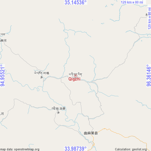
Qigzhi GPS coordinates[2]
34° 34' 6.204" North, 95° 39' 29.988" East
| Map corner | latitude | longitude |
|---|---|---|
| Upper-left | 35.14536°, | 94.95521° |
| Center: | 34.56839°, | 95.65833° |
| Lower-right: | 33.98739°, | 96.36146° |
| Map W x H: | 128.8×128.8 km | = 80×80mi |
| max Lat: | 53.31946° ⇑26.9% North |
| Qigzhi: | 34.56839° |
| min Lat: | ⇓73.1% South 18.22056° |
| min Long | Qigzhi | max Long |
| 75.07348° | 95.65833° | 134.28917° |
| W 4.1%⇐ | ⇒95.9% E |
Elevation
Elevation of Qigzhi is 4323 m = 14183 ft, and this is 3838.2 m = 12593 ft above average elevation for this country.
| Max E: |
5622 m = 18445 ft | 0.7% |
| Qigzhi | 4323 m 14183 ft | |
| Avg. | 484.8 m = 1591 ft | |
Min E: |
-3 m = -10 ft | 99.3% |
See also: China elevation on elevation.city.
Geographical zone
Qigzhi is located in North temperate zone (between Tropic of Cancer and the Arctic Circle). Distance of this Northern Tropic circle is 1237.7 km =769.1 mi to South.| Distance of | km | miles | from Qigzhi |
|---|---|---|---|
| North Pole | 6163.4 | 3829.8 | to North |
| Arctic Circle | 3557.5 | 2210.5 | to North |
| Tropic Cancer | 1237.7 | 769.1 | to South |
| Equator | 3843.6 | 2388.3 | to South |


Nearby cities:
15 places around Qigzhi: (largest is in red/bold)
• Aduo
189.6 km =117.8 mi,  197°
197°
• Anchong
152 km =94.4 mi,  143°
143°
• Bagan
108.9 km =67.7 mi,  133°
133°
• Dongfeng
74.5 km =46.3 mi, 135°
• Duocai
87.1 km =54.1 mi,  194°
194°
• Gaduo
137.9 km =85.7 mi, 136°
• Gyairong
160.6 km =99.8 mi,  153°
153°
• Linxin
113.7 km =70.6 mi,  160°
160°
• Madoi
82.6 km =51.3 mi,  52°
52°
• Qingshuihe
160.3 km =99.6 mi,  122°
122°
• Yege
28.9 km =18 mi,  271°
271°
• Zadoi
133.5 km =83 mi, 131°
• Zaqing
172.8 km =107.4 mi, 195°
• Zhiqu
32.2 km =20 mi,  206°
206°
• Zhoinda
198 km =123 mi, 140°
Sources, notices
• [Note1] Compared only with cities in China existing in our database
• [Src1] Map data: © OpenStreetMap contributors (CC-BY-SA)
• [Src2] Other city data from geonames.org with taken over terms of usage.
• [Src3] Geographical zone / Annual Mean Temperature by Robert A. Rohde @ Wikipedia
