Nechí geodata
Nechí (Antioquia) is a seat of a second-order administrative division; located in Colombia in America/Bogota (GMT-5) time zone. With population of 6,693 people, there are 418 cities with bigger population in this country. Compared to other cities in Colombia, 81.4% of cities are located further ↓South; 51.2% of cities are located further ←West and 89.6% of cities have higher elevation than Nechí. Note1


Nechí GPS coordinates[2]
8° 5' 39.084" North, 74° 46' 32.628" West
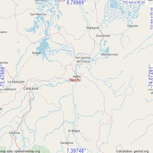
| Map corner | latitude | longitude |
|---|---|---|
| Upper-left | 8.78969°, | -75.47886° |
| Center: | 8.09419°, | -74.77573° |
| Lower-right: | 7.39748°, | -74.07261° |
| Map W x H: | 154.8×154.8 km | = 96.2×96.2mi |
| max Lat: | 13.38166° ⇑18.6% North |
| Nechí: | 8.09419° |
| min Lat: | ⇓81.4% South -4.21528° |
| min Long | Nechí | max Long |
| -81.70636° | -74.77573° | -67.06996° |
| W 51.2%⇐ | ⇒48.8% E |
Elevation
Elevation of Nechí is 31 m = 102 ft, and this is 1118.3 m = 3669 ft below average elevation for this country.
| Max E: |
3342 m = 10965 ft | 89.6% |
| Avg. | 1149.3 m = 3771 ft | |
| Nechí | 31 m = 102 ft | |
Min E: |
1 m = 3 ft | 10.4% |
See also: Colombia elevation on elevation.city.
Geographical zone
Nechí is located in North Torrid zone (between Equator and Tropic of Cancer). Distance of Equator is 900 km =559.2 mi to South.| Distance of | km | miles | from Nechí |
|---|---|---|---|
| North Pole | 9107.1 | 5658.9 | to North |
| Arctic Circle | 6501.2 | 4039.7 | to North |
| Tropic Cancer | 1705.9 | 1060 | to North |
| Equator | 900 | 559.2 | to South |


Nearby cities:
15 places around Nechí: (largest is in red/bold)
• Achí
58.1 km =36.1 mi,  24°
24°
• Ayapel
46.9 km =29.1 mi,  301°
301°
• Caucasia
47.5 km =29.5 mi,  255°
255°
• El Bagre
54.7 km =34 mi,  183°
183°
• Guaranda
49.2 km =30.6 mi,  32°
32°
• La Apartada
62 km =38.5 mi,  265°
265°
• Majagual
52.2 km =32.4 mi, 17°
• Montecristo
40.2 km =25 mi,  55°
55°
• Montelíbano
72.1 km =44.8 mi, 259°
• Pueblo Nuevo
25.9 km =16.1 mi,  309°
309°
• San Carlos
33.6 km =20.9 mi, 179°
• San Jacinto del Cauca
18.3 km =11.4 mi, 19°
• San Marcos
73.9 km =45.9 mi,  328°
328°
• Tiquisio
76.3 km =47.4 mi,  47°
47°
• Zaragoza
68 km =42.3 mi,  188°
188°
Sources, notices
• [Note1] Compared only with cities in Colombia existing in our database
• [Src1] Map data: © OpenStreetMap contributors (CC-BY-SA)
• [Src2] Other city data from geonames.org with taken over terms of usage.
• [Src3] Geographical zone / Annual Mean Temperature by Robert A. Rohde @ Wikipedia
