La Cruz geodata
La Cruz (Guanacaste) is a populated place; located in Costa Rica in America/Costa_Rica (GMT-6) time zone. With population of 4,319 people, there are 80 cities with bigger population in this country. Compared to other cities in Costa Rica, 100% of cities are located further ↓South; 99.3% of cities are located further →East and 70.1% of cities have higher elevation than La Cruz. Note1


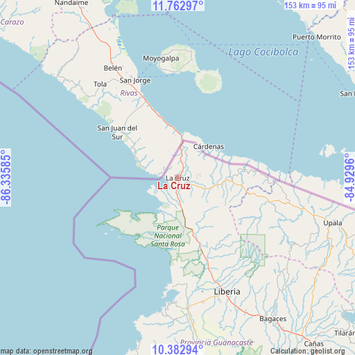
La Cruz GPS coordinates[2]
11° 4' 25.572" North, 85° 37' 57.792" West
| Map corner | latitude | longitude |
|---|---|---|
| Upper-left | 11.76297°, | -86.33585° |
| Center: | 11.07377°, | -85.63272° |
| Lower-right: | 10.38294°, | -84.9296° |
| Map W x H: | 153.4×153.4 km | = 95.3×95.3mi |
| max Lat: | 11.07377° ⇑0% North |
| La Cruz: | 11.07377° |
| min Lat: | ⇓100% South 8.53305° |
| min Long | La Cruz | max Long |
| -85.64748° | -85.63272° | -82.62185° |
| W 0.7%⇐ | ⇒99.3% E |
Elevation
Elevation of La Cruz is 241 m = 791 ft, and this is 494 m = 1621 ft below average elevation for this country.
| Max E: |
1844 m = 6050 ft | 70.1% |
| Avg. | 735 m = 2411 ft | |
| La Cruz | 241 m = 791 ft | |
Min E: |
7 m = 23 ft | 29.9% |
See also: Costa Rica elevation on elevation.city.
Geographical zone
La Cruz is located in North Torrid zone (between Equator and Tropic of Cancer). Distance of Equator is 1231.3 km =765.1 mi to South.| Distance of | km | miles | from La Cruz |
|---|---|---|---|
| North Pole | 8775.8 | 5453 | to North |
| Arctic Circle | 6169.9 | 3833.8 | to North |
| Tropic Cancer | 1374.6 | 854.1 | to North |
| Equator | 1231.3 | 765.1 | to South |


Nearby cities:
15 places around La Cruz: (largest is in red/bold)
• Bagaces
73.6 km =45.7 mi,  145°
145°
• Belén
74.2 km =46.1 mi,  176°
176°
• Bijagua
73.4 km =45.6 mi,  121°
121°
• Cañas
92.3 km =57.4 mi,  140°
140°
• Fortuna
64.9 km =40.3 mi,  133°
133°
• Hojancha
115.4 km =71.7 mi,  168°
168°
• Juntas
114.8 km =71.3 mi, 140°
• Liberia
53.2 km =33.1 mi,  156°
156°
• Los Chiles
100.1 km =62.2 mi,  92°
92°
• Nicoya
104.6 km =65 mi, 169°
• San José
55.9 km =34.7 mi,  104°
104°
• Santa Cruz
90.6 km =56.3 mi, 176°
• Sardinal
62 km =38.5 mi, 181°
• Tilarán
99.1 km =61.6 mi, 132°
• Upala
70.3 km =43.7 mi,  106°
106°
Sources, notices
• [Note1] Compared only with cities in Costa Rica existing in our database
• [Src1] Map data: © OpenStreetMap contributors (CC-BY-SA)
• [Src2] Other city data from geonames.org with taken over terms of usage.
• [Src3] Geographical zone / Annual Mean Temperature by Robert A. Rohde @ Wikipedia
