Rizokárpaso geodata
Rizokárpaso (Ammochostos) is a populated place; located in Cyprus in Asia/Famagusta (GMT+3) time zone. With population of 5,215 people, there are 20 cities with bigger population in this country. Compared to other cities in Cyprus, 100% of cities are located further ↓South; 100% of cities are located further ←West and 52.1% of cities have lower elevation than Rizokárpaso. Note1


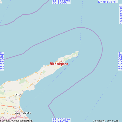
Rizokárpaso GPS coordinates[2]
35° 35' 49.884" North, 34° 22' 44.976" East
| Map corner | latitude | longitude |
|---|---|---|
| Upper-left | 36.16687°, | 33.67604° |
| Center: | 35.59719°, | 34.37916° |
| Lower-right: | 35.02342°, | 35.08229° |
| Map W x H: | 127.1×127.1 km | = 79×79mi |
| max Lat: | 35.59719° ⇑0% North |
| Rizokárpaso: | 35.59719° |
| min Lat: | ⇓100% South 34.66865° |
| min Long | Rizokárpaso | max Long |
| 32.38166° | 34.37916° | 34.37916° |
| W 100%⇐ | ⇒0% E |
Elevation
Elevation of Rizokárpaso is 133 m = 436 ft, and this is 75 m = 246 ft below average elevation for this country.
| Max E: |
1134 m = 3720 ft | 47.9% |
| Avg. | 208 m = 682 ft | |
| Rizokárpaso | 133 m = 436 ft | |
Min E: |
4 m = 13 ft | 52.1% |
See also: Cyprus elevation on elevation.city.
Geographical zone
Rizokárpaso is located in North temperate zone (between Tropic of Cancer and the Arctic Circle). Distance of this Northern Tropic circle is 1352.1 km =840.2 mi to South.| Distance of | km | miles | from Rizokárpaso |
|---|---|---|---|
| North Pole | 6049 | 3758.7 | to North |
| Arctic Circle | 3443.1 | 2139.4 | to North |
| Tropic Cancer | 1352.1 | 840.2 | to South |
| Equator | 3958 | 2459.4 | to South |


Nearby cities:
15 places around Rizokárpaso: (largest is in red/bold)
• Acherítou
72.5 km =45 mi,  220°
220°
• Avgórou
79.3 km =49.3 mi, 218°
• Ayia Napa
76.5 km =47.5 mi,  206°
206°
• Derýneia
70.3 km =43.7 mi, 212°
• Famagusta
66.4 km =41.3 mi, 216°
• Frénaros
74.4 km =46.2 mi, 213°
• Lefkónoiko
69.6 km =43.2 mi,  237°
237°
• Leonárisso
26 km =16.2 mi, 236°
• Liopétri
78.9 km =49 mi, 214°
• Paralímni
71.7 km =44.6 mi, 210°
• Protaras
71.2 km =44.2 mi,  204°
204°
• Tríkomo
56.1 km =34.9 mi,  231°
231°
• Xylofágou
84.1 km =52.3 mi, 214°
• Xylotymbou
86.6 km =53.8 mi, 221°
• Áchna
80.9 km =50.3 mi, 221°
Sources, notices
• [Note1] Compared only with cities in Cyprus existing in our database
• [Src1] Map data: © OpenStreetMap contributors (CC-BY-SA)
• [Src2] Other city data from geonames.org with taken over terms of usage.
• [Src3] Geographical zone / Annual Mean Temperature by Robert A. Rohde @ Wikipedia
