Thalmässing geodata
Thalmässing (Bavaria) is a populated place; located in Germany in Europe/Berlin (GMT+2) time zone. With population of 5,442 people, there are 2649 cities with bigger population in this country. Compared to other cities in Germany, 81.9% of cities are located further ↑North; 70.3% of cities are located further ←West and 77.4% of cities have lower elevation than Thalmässing. Note1
Administrative division(s):
- Level 1: Bavaria
- Level 2: Regierungsbezirk Mittelfranken
- Level 3: Landkreis Roth
- Level 4: Thalmässing, Markt


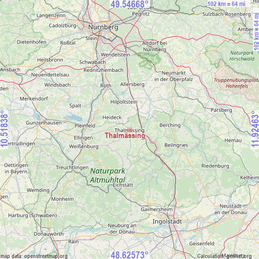
Thalmässing GPS coordinates[2]
49° 5' 18.024" North, 11° 13' 17.4" East
| Map corner | latitude | longitude |
|---|---|---|
| Upper-left | 49.54668°, | 10.51838° |
| Center: | 49.08834°, | 11.2215° |
| Lower-right: | 48.62573°, | 11.92463° |
| Map W x H: | 102.4×102.4 km | = 63.6×63.6mi |
| max Lat: | 55.01917° ⇑81.9% North |
| Thalmässing: | 49.08834° |
| min Lat: | ⇓18.1% South 47.40724° |
| min Long | Thalmässing | max Long |
| 5.92978° | 11.2215° | 14.98853° |
| W 70.3%⇐ | ⇒29.7% E |
Elevation
Elevation of Thalmässing is 415 m = 1362 ft, and this is 165.9 m = 544 ft above average elevation for this country.
| Max E: |
1256 m = 4121 ft | 22.6% |
| Thalmässing | 415 m 1362 ft | |
| Avg. | 249.1 m = 817 ft | |
Min E: |
-5 m = -16 ft | 77.4% |
See also: Germany elevation on elevation.city.
Geographical zone
Thalmässing is located in North temperate zone (between Tropic of Cancer and the Arctic Circle). Distance of this North polar circle is 1943.1 km =1207.4 mi to North.| Distance of | km | miles | from Thalmässing |
|---|---|---|---|
| North Pole | 4549 | 2826.6 | to North |
| Arctic Circle | 1943.1 | 1207.4 | to North |
| Tropic Cancer | 2852.2 | 1772.3 | to South |
| Equator | 5458.1 | 3391.5 | to South |


Nearby cities:
15 places around Thalmässing: (largest is in red/bold)
• Allersberg
18.2 km =11.3 mi,  3°
3°
• Berching
16.1 km =10 mi,  82°
82°
• Bergen
8 km =5 mi,  258°
258°
• Burgsalach
10.9 km =6.8 mi,  235°
235°
• Ettenstatt
12.2 km =7.6 mi, 264°
• Freystadt
14.7 km =9.1 mi,  32°
32°
• Greding
10.9 km =6.8 mi,  114°
114°
• Heideck
8.5 km =5.3 mi,  306°
306°
• Hilpoltstein
11.6 km =7.2 mi,  348°
348°
• Höttingen
16 km =9.9 mi, 259°
• Nennslingen
8.1 km =5 mi, 235°
• Pleinfeld
17.5 km =10.9 mi,  275°
275°
• Pollenfeld
15.5 km =9.6 mi,  185°
185°
• Raitenbuch
10.8 km =6.7 mi,  220°
220°
• Röttenbach
15.3 km =9.5 mi,  296°
296°
Sources, notices
• [Note1] Compared only with cities in Germany existing in our database
• [Src1] Map data: © OpenStreetMap contributors (CC-BY-SA)
• [Src2] Other city data from geonames.org with taken over terms of usage.
• [Src3] Geographical zone / Annual Mean Temperature by Robert A. Rohde @ Wikipedia
