Ehekirchen geodata
Ehekirchen (Bavaria) is a seat of a fourth-order administrative division; located in Germany in Europe/Berlin (GMT+2) time zone. With population of 3,782 people, there are 3415 cities with bigger population in this country. Compared to other cities in Germany, 87.4% of cities are located further ↑North; 68.4% of cities are located further ←West and 77.7% of cities have lower elevation than Ehekirchen. Note1
Administrative division(s):
- Level 1: Bavaria
- Level 2: Upper Bavaria
- Level 3: Landkreis Neuburg-Schrobenhausen
- Level 4: Ehekirchen


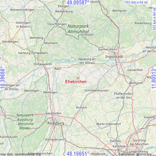
Ehekirchen GPS coordinates[2]
48° 37' 59.988" North, 11° 6' 0" East
| Map corner | latitude | longitude |
|---|---|---|
| Upper-left | 49.09587°, | 10.39688° |
| Center: | 48.63333°, | 11.1° |
| Lower-right: | 48.16651°, | 11.80313° |
| Map W x H: | 103.3×103.3 km | = 64.2×64.2mi |
| max Lat: | 55.01917° ⇑87.4% North |
| Ehekirchen: | 48.63333° |
| min Lat: | ⇓12.6% South 47.40724° |
| min Long | Ehekirchen | max Long |
| 5.92978° | 11.1° | 14.98853° |
| W 68.4%⇐ | ⇒31.6% E |
Elevation
Elevation of Ehekirchen is 417 m = 1368 ft, and this is 167.9 m = 551 ft above average elevation for this country.
| Max E: |
1256 m = 4121 ft | 22.3% |
| Ehekirchen | 417 m 1368 ft | |
| Avg. | 249.1 m = 817 ft | |
Min E: |
-5 m = -16 ft | 77.7% |
See also: Germany elevation on elevation.city.
Geographical zone
Ehekirchen is located in North temperate zone (between Tropic of Cancer and the Arctic Circle). Distance of this North polar circle is 1993.7 km =1238.8 mi to North.| Distance of | km | miles | from Ehekirchen |
|---|---|---|---|
| North Pole | 4599.5 | 2858 | to North |
| Arctic Circle | 1993.7 | 1238.8 | to North |
| Tropic Cancer | 2801.6 | 1740.8 | to South |
| Equator | 5407.5 | 3360.1 | to South |


Nearby cities:
15 places around Ehekirchen: (largest is in red/bold)
• Berg im Gau
11 km =6.8 mi,  90°
90°
• Burgheim
9.7 km =6 mi,  320°
320°
• Holzheim
11.4 km =7.1 mi,  257°
257°
• Inchenhofen
13.4 km =8.3 mi,  175°
175°
• Karlshuld
14.6 km =9.1 mi,  68°
68°
• Langenmosen
8.9 km =5.5 mi,  109°
109°
• Münster
14.6 km =9.1 mi,  265°
265°
• Neuburg an der Donau
12.7 km =7.9 mi,  30°
30°
• Oberhausen
9.9 km =6.2 mi,  4°
4°
• Petersdorf
13.9 km =8.6 mi,  200°
200°
• Pöttmes
5.6 km =3.5 mi,  189°
189°
• Rain
14.9 km =9.3 mi,  295°
295°
• Rennertshofen
14.6 km =9.1 mi,  344°
344°
• Rohrenfels
7.2 km =4.5 mi, 34°
• Schrobenhausen
14.3 km =8.9 mi,  124°
124°
Sources, notices
• [Note1] Compared only with cities in Germany existing in our database
• [Src1] Map data: © OpenStreetMap contributors (CC-BY-SA)
• [Src2] Other city data from geonames.org with taken over terms of usage.
• [Src3] Geographical zone / Annual Mean Temperature by Robert A. Rohde @ Wikipedia
