Nordby geodata
Nordby (South Denmark) is a seat of a second-order administrative division; located in Denmark in Europe/Copenhagen (GMT+2) time zone. With population of 2,512 people, there are 251 cities with bigger population in this country. Compared to other cities in Denmark, 72.8% of cities are located further ↑North; 98% of cities are located further →East and 92.7% of cities have higher elevation than Nordby. Note1


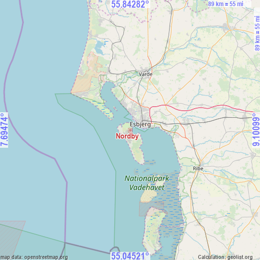
Nordby GPS coordinates[2]
55° 26' 45.708" North, 8° 23' 52.296" East
| Map corner | latitude | longitude |
|---|---|---|
| Upper-left | 55.84282°, | 7.69474° |
| Center: | 55.44603°, | 8.39786° |
| Lower-right: | 55.04521°, | 9.10099° |
| Map W x H: | 88.7×88.7 km | = 55.1×55.1mi |
| max Lat: | 57.72093° ⇑72.8% North |
| Nordby: | 55.44603° |
| min Lat: | ⇓27.2% South 54.57644° |
| min Long | Nordby | max Long |
| 8.12605° | 8.39786° | 15.18662° |
| W 2%⇐ | ⇒98% E |
Elevation
Elevation of Nordby is 4 m = 13 ft, and this is 23.3 m = 76 ft below average elevation for this country.
| Max E: |
114 m = 374 ft | 92.7% |
| Avg. | 27.3 m = 90 ft | |
| Nordby | 4 m = 13 ft | |
Min E: |
0 m = 0 ft | 7.3% |
See also: Denmark elevation on elevation.city.
Geographical zone
Nordby is located in North temperate zone (between Tropic of Cancer and the Arctic Circle). Distance of this North polar circle is 1236.2 km =768.1 mi to North.| Distance of | km | miles | from Nordby |
|---|---|---|---|
| North Pole | 3842 | 2387.3 | to North |
| Arctic Circle | 1236.2 | 768.1 | to North |
| Tropic Cancer | 3559.1 | 2211.5 | to South |
| Equator | 6165 | 3830.8 | to South |


Nearby cities:
15 places around Nordby: (largest is in red/bold)
• Bramming
19.2 km =11.9 mi,  82°
82°
• Brørup
39.3 km =24.4 mi, 84°
• Esbjerg
4.3 km =2.7 mi,  51°
51°
• Gram
44.7 km =27.8 mi,  112°
112°
• Grindsted
48 km =29.8 mi,  43°
43°
• Holsted
33.6 km =20.9 mi, 77°
• Oksbøl
21.3 km =13.2 mi,  340°
340°
• Ribe
26.8 km =16.7 mi,  118°
118°
• Rødding
42.9 km =26.7 mi,  102°
102°
• Skaerbaek
39.8 km =24.7 mi,  143°
143°
• Tjæreborg
11.6 km =7.2 mi, 79°
• Toftlund
51.2 km =31.8 mi, 123°
• Varde
20.2 km =12.6 mi,  14°
14°
• Vejen
46.8 km =29.1 mi,  85°
85°
• Ølgod
42.7 km =26.5 mi,  19°
19°
Sources, notices
• [Note1] Compared only with cities in Denmark existing in our database
• [Src1] Map data: © OpenStreetMap contributors (CC-BY-SA)
• [Src2] Other city data from geonames.org with taken over terms of usage.
• [Src3] Geographical zone / Annual Mean Temperature by Robert A. Rohde @ Wikipedia
