Sétif geodata
Sétif is a seat of a first-order administrative division; located in Algeria in Africa/Algiers (GMT+1) time zone. With population of 288,461 people, there are 6 cities with bigger population in this country. Compared to other cities in Algeria, 55.8% of cities are located further ↓South; 74.4% of cities are located further ←West and 95% of cities have lower elevation than Sétif. Note1


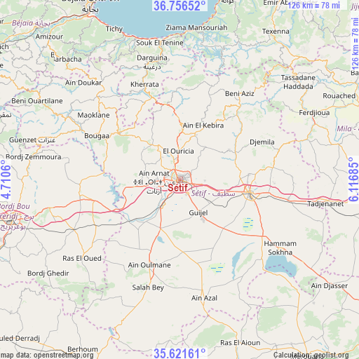
Sétif GPS coordinates[2]
36° 11' 28.032" North, 5° 24' 49.428" East
| Map corner | latitude | longitude |
|---|---|---|
| Upper-left | 36.75652°, | 4.7106° |
| Center: | 36.19112°, | 5.41373° |
| Lower-right: | 35.62161°, | 6.11685° |
| Map W x H: | 126.2×126.2 km | = 78.4×78.4mi |
| max Lat: | 36.92917° ⇑44.2% North |
| Sétif: | 36.19112° |
| min Lat: | ⇓55.8% South 22.785° |
| min Long | Sétif | max Long |
| -8.14743° | 5.41373° | 8.46667° |
| W 74.4%⇐ | ⇒25.6% E |
Elevation
Elevation of Sétif is 1096 m = 3596 ft, and this is 657.5 m = 2157 ft above average elevation for this country.
| Max E: |
1392 m = 4567 ft | 5% |
| Sétif | 1096 m 3596 ft | |
| Avg. | 438.5 m = 1439 ft | |
Min E: |
5 m = 16 ft | 95% |
See also: Sétif elevation on elevation.city.
Geographical zone
Sétif is located in North temperate zone (between Tropic of Cancer and the Arctic Circle). Distance of this Northern Tropic circle is 1418.2 km =881.2 mi to South.| Distance of | km | miles | from Sétif |
|---|---|---|---|
| North Pole | 5983 | 3717.7 | to North |
| Arctic Circle | 3377.1 | 2098.4 | to North |
| Tropic Cancer | 1418.2 | 881.2 | to South |
| Equator | 4024.1 | 2500.5 | to South |


Nearby cities:
15 places around Sétif: (largest is in red/bold)
• Amizour
67.8 km =42.1 mi,  317°
317°
• Aïn Arnat
9 km =5.6 mi,  266°
266°
• BABOR - VILLE
35.1 km =21.8 mi,  18°
18°
• Barbacha
57.8 km =35.9 mi, 316°
• Bordj Bou Arreridj
60.1 km =37.3 mi,  257°
257°
• Bordj Ghdir
56.5 km =35.1 mi,  235°
235°
• Bordj Zemoura
50.8 km =31.6 mi,  280°
280°
• Bougaa
33.2 km =20.6 mi,  298°
298°
• Chelghoum el Aïd
67.6 km =42 mi,  92°
92°
• El Eulma
25.2 km =15.7 mi,  99°
99°
• Feraoun
64.7 km =40.2 mi,  309°
309°
• Rouached
63.7 km =39.6 mi,  62°
62°
• Râs el Aïoun
61.2 km =38 mi,  160°
160°
• Râs el Oued
44 km =27.3 mi,  231°
231°
• Salah Bey
39 km =24.2 mi,  196°
196°
Sources, notices
• [Note1] Compared only with cities in Algeria existing in our database
• [Src1] Map data: © OpenStreetMap contributors (CC-BY-SA)
• [Src2] Other city data from geonames.org with taken over terms of usage.
• [Src3] Geographical zone / Annual Mean Temperature by Robert A. Rohde @ Wikipedia
