BABOR - VILLE geodata
BABOR - VILLE (Sétif) is a populated place; located in Algeria in Africa/Algiers (GMT+1) time zone. With population of 33,000 people, there are 154 cities with bigger population in this country. Compared to other cities in Algeria, 68.2% of cities are located further ↓South; 75.6% of cities are located further ←West and 86.4% of cities have lower elevation than BABOR - VILLE. Note1


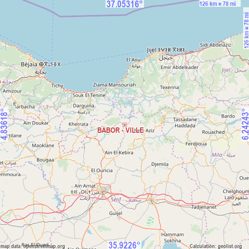
BABOR - VILLE GPS coordinates[2]
36° 29' 23.784" North, 5° 32' 21.48" East
| Map corner | latitude | longitude |
|---|---|---|
| Upper-left | 37.05316°, | 4.83618° |
| Center: | 36.48994°, | 5.5393° |
| Lower-right: | 35.9226°, | 6.24243° |
| Map W x H: | 125.7×125.7 km | = 78.1×78.1mi |
| max Lat: | 36.92917° ⇑31.8% North |
| BABOR - VILLE: | 36.48994° |
| min Lat: | ⇓68.2% South 22.785° |
| min Long | BABOR - VILLE | max Long |
| -8.14743° | 5.5393° | 8.46667° |
| W 75.6%⇐ | ⇒24.4% E |
Elevation
Elevation of BABOR - VILLE is 944 m = 3097 ft, and this is 505.5 m = 1658 ft above average elevation for this country.
| Max E: |
1392 m = 4567 ft | 13.6% |
| BABOR - VILLE | 944 m 3097 ft | |
| Avg. | 438.5 m = 1439 ft | |
Min E: |
5 m = 16 ft | 86.4% |
See also: Algeria elevation on elevation.city.
Geographical zone
BABOR - VILLE is located in North temperate zone (between Tropic of Cancer and the Arctic Circle). Distance of this Northern Tropic circle is 1451.4 km =901.9 mi to South.| Distance of | km | miles | from BABOR - VILLE |
|---|---|---|---|
| North Pole | 5949.8 | 3697 | to North |
| Arctic Circle | 3343.9 | 2077.8 | to North |
| Tropic Cancer | 1451.4 | 901.9 | to South |
| Equator | 4057.3 | 2521.1 | to South |


Nearby cities:
15 places around BABOR - VILLE: (largest is in red/bold)
• Amizour
59.4 km =36.9 mi,  286°
286°
• Aïn Arnat
39.3 km =24.4 mi,  210°
210°
• Barbacha
51.9 km =32.2 mi,  279°
279°
• Bejaïa
50.2 km =31.2 mi,  306°
306°
• Bordj Zemoura
65.6 km =40.8 mi,  248°
248°
• Bougaa
44 km =27.3 mi, 246°
• Chelghoum el Aïd
66.9 km =41.6 mi,  122°
122°
• El Eulma
39.8 km =24.7 mi,  160°
160°
• El Kseur
64.6 km =40.1 mi, 289°
• Feraoun
61.7 km =38.3 mi, 277°
• Jijel
42 km =26.1 mi,  28°
28°
• Mila
65 km =40.4 mi,  93°
93°
• Rouached
45.1 km =28 mi, 94°
• Sidi Mérouane
64.6 km =40.1 mi, 86°
• Sétif
35.1 km =21.8 mi,  198°
198°
Sources, notices
• [Note1] Compared only with cities in Algeria existing in our database
• [Src1] Map data: © OpenStreetMap contributors (CC-BY-SA)
• [Src2] Other city data from geonames.org with taken over terms of usage.
• [Src3] Geographical zone / Annual Mean Temperature by Robert A. Rohde @ Wikipedia
