El Bayadh geodata
El Bayadh is a seat of a first-order administrative division; located in Algeria in Africa/Algiers (GMT+1) time zone. With population of 64,632 people, there are 69 cities with bigger population in this country. Compared to other cities in Algeria, 88.8% of cities are located further ↑North; 79.8% of cities are located further →East and 99.2% of cities have lower elevation than El Bayadh. Note1


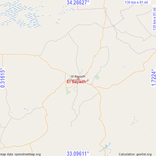
El Bayadh GPS coordinates[2]
33° 40' 59.448" North, 1° 1' 9.372" East
| Map corner | latitude | longitude |
|---|---|---|
| Upper-left | 34.26627°, | 0.31615° |
| Center: | 33.68318°, | 1.01927° |
| Lower-right: | 33.09611°, | 1.7224° |
| Map W x H: | 130.1×130.1 km | = 80.8×80.8mi |
| max Lat: | 36.92917° ⇑88.8% North |
| El Bayadh: | 33.68318° |
| min Lat: | ⇓11.2% South 22.785° |
| min Long | El Bayadh | max Long |
| -8.14743° | 1.01927° | 8.46667° |
| W 20.2%⇐ | ⇒79.8% E |
Elevation
Elevation of El Bayadh is 1310 m = 4298 ft, and this is 871.5 m = 2859 ft above average elevation for this country.
| Max E: |
1392 m = 4567 ft | 0.8% |
| El Bayadh | 1310 m 4298 ft | |
| Avg. | 438.5 m = 1439 ft | |
Min E: |
5 m = 16 ft | 99.2% |
See also: El Bayadh elevation on elevation.city.
Geographical zone
El Bayadh is located in North temperate zone (between Tropic of Cancer and the Arctic Circle). Distance of this Northern Tropic circle is 1139.3 km =707.9 mi to South.| Distance of | km | miles | from El Bayadh |
|---|---|---|---|
| North Pole | 6261.8 | 3890.9 | to North |
| Arctic Circle | 3656 | 2271.7 | to North |
| Tropic Cancer | 1139.3 | 707.9 | to South |
| Equator | 3745.2 | 2327.2 | to South |


Nearby cities:
15 places around El Bayadh: (largest is in red/bold)
• Aflou
110.8 km =68.8 mi,  64°
64°
• Aïn Sefra
181.6 km =112.8 mi,  235°
235°
• Brezina
68.7 km =42.7 mi,  160°
160°
• Charef
193.8 km =120.4 mi, 57°
• Djebilet Rosfa
132.4 km =82.3 mi,  352°
352°
• El Abiodh Sidi Cheikh
98.2 km =61 mi,  206°
206°
• El Idrissia
162.7 km =101.1 mi, 58°
• Frenda
153.7 km =95.5 mi,  1°
1°
• Laghouat
171.2 km =106.4 mi,  85°
85°
• Naama
132.3 km =82.2 mi,  249°
249°
• Saïda
150.4 km =93.5 mi,  327°
327°
• Sougueur
172.7 km =107.3 mi,  14°
14°
• Tiaret
189.6 km =117.8 mi, 8°
• ’Aïn Deheb
137.7 km =85.6 mi,  20°
20°
• ’Aïn el Hadjar
144.1 km =89.5 mi, 326°
Sources, notices
• [Note1] Compared only with cities in Algeria existing in our database
• [Src1] Map data: © OpenStreetMap contributors (CC-BY-SA)
• [Src2] Other city data from geonames.org with taken over terms of usage.
• [Src3] Geographical zone / Annual Mean Temperature by Robert A. Rohde @ Wikipedia
