Salaga geodata
Salaga (Northern) is a populated place; located in Ghana in Africa/Accra (GMT+0) time zone. With population of 25,472 people, there are 48 cities with bigger population in this country. Compared to other cities in Ghana, 90.3% of cities are located further ↓South; 65.3% of cities are located further ←West and 50% of cities have lower elevation than Salaga. Note1


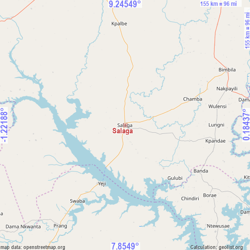
Salaga GPS coordinates[2]
8° 33' 2.988" North, 0° 31' 7.5" West
| Map corner | latitude | longitude |
|---|---|---|
| Upper-left | 9.24549°, | -1.22188° |
| Center: | 8.55083°, | -0.51875° |
| Lower-right: | 7.8549°, | 0.18437° |
| Map W x H: | 154.6×154.6 km | = 96.1×96.1mi |
| max Lat: | 11.0616° ⇑9.7% North |
| Salaga: | 8.55083° |
| min Lat: | ⇓90.3% South 4.86641° |
| min Long | Salaga | max Long |
| -2.78516° | -0.51875° | 1.19012° |
| W 65.3%⇐ | ⇒34.7% E |
Elevation
Elevation of Salaga is 163 m = 535 ft, and this is 7.2 m = 24 ft below average elevation for this country.
| Max E: |
477 m = 1565 ft | 50% |
| Avg. | 170.2 m = 558 ft | |
| Salaga | 163 m = 535 ft | |
Min E: |
0 m = 0 ft | 50% |
See also: Ghana elevation on elevation.city.
Geographical zone
Salaga is located in North Torrid zone (between Equator and Tropic of Cancer). Distance of Equator is 950.8 km =590.8 mi to South.| Distance of | km | miles | from Salaga |
|---|---|---|---|
| North Pole | 9056.3 | 5627.3 | to North |
| Arctic Circle | 6450.4 | 4008.1 | to North |
| Tropic Cancer | 1655.2 | 1028.5 | to North |
| Equator | 950.8 | 590.8 | to South |


Nearby cities:
15 places around Salaga: (largest is in red/bold)
• Agogo
204.3 km =126.9 mi,  197°
197°
• Ejura
159 km =98.8 mi,  215°
215°
• Hohoe
190.1 km =118.1 mi,  144°
144°
• Kete Krachi
98.7 km =61.3 mi,  148°
148°
• Kintampo
144.2 km =89.6 mi,  247°
247°
• Kpandae
56.5 km =35.1 mi,  99°
99°
• Kpandu
194.7 km =121 mi, 152°
• Mampong
191.8 km =119.2 mi,  210°
210°
• Mpraeso
219 km =136.1 mi,  186°
186°
• Odumase Krobo
226.7 km =140.9 mi, 188°
• Savelugu
124 km =77.1 mi,  344°
344°
• Tamale
100.9 km =62.7 mi, 339°
• Techiman
189.7 km =117.9 mi,  235°
235°
• Wenchi
196.5 km =122.1 mi, 242°
• Yendi
113.8 km =70.7 mi,  29°
29°
Sources, notices
• [Note1] Compared only with cities in Ghana existing in our database
• [Src1] Map data: © OpenStreetMap contributors (CC-BY-SA)
• [Src2] Other city data from geonames.org with taken over terms of usage.
• [Src3] Geographical zone / Annual Mean Temperature by Robert A. Rohde @ Wikipedia
