Camotán geodata
Camotán (Chiquimula) is a seat of a second-order administrative division; located in Guatemala in America/Guatemala (GMT-6) time zone. With population of 1,597 people, there are 294 cities with bigger population in this country. Compared to other cities in Guatemala, 51.9% of cities are located further ↓South; 97.1% of cities are located further ←West and 74.9% of cities have higher elevation than Camotán. Note1


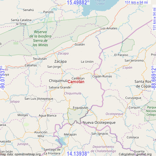
Camotán GPS coordinates[2]
14° 49' 12.612" North, 89° 22' 20.064" West
| Map corner | latitude | longitude |
|---|---|---|
| Upper-left | 15.49882°, | -90.07537° |
| Center: | 14.82017°, | -89.37224° |
| Lower-right: | 14.13938°, | -88.66912° |
| Map W x H: | 151.2×151.2 km | = 94×94mi |
| max Lat: | 17.06606° ⇑48.1% North |
| Camotán: | 14.82017° |
| min Lat: | ⇓51.9% South 13.9274° |
| min Long | Camotán | max Long |
| -92.19298° | -89.37224° | -88.59444° |
| W 97.1%⇐ | ⇒2.9% E |
Elevation
Elevation of Camotán is 465 m = 1526 ft, and this is 802 m = 2631 ft below average elevation for this country.
| Max E: |
3254 m = 10676 ft | 74.9% |
| Avg. | 1267 m = 4157 ft | |
| Camotán | 465 m = 1526 ft | |
Min E: |
1 m = 3 ft | 25.1% |
See also: Guatemala elevation on elevation.city.
Geographical zone
Camotán is located in North Torrid zone (between Equator and Tropic of Cancer). Distance of this Northern Tropic circle is 958.1 km =595.3 mi to North.| Distance of | km | miles | from Camotán |
|---|---|---|---|
| North Pole | 8359.2 | 5194.2 | to North |
| Arctic Circle | 5753.3 | 3574.9 | to North |
| Tropic Cancer | 958.1 | 595.3 | to North |
| Equator | 1647.8 | 1023.9 | to South |


Nearby cities:
15 places around Camotán: (largest is in red/bold)
• Chiquimula
18.8 km =11.7 mi,  263°
263°
• Concepción Las Minas
34.4 km =21.4 mi,  195°
195°
• Esquipulas
28.4 km =17.6 mi,  175°
175°
• Estanzuela
28.9 km =18 mi,  313°
313°
• Gualán
33.3 km =20.7 mi,  2°
2°
• Ipala
34.7 km =21.6 mi,  229°
229°
• Jocotán
1.9 km =1.2 mi,  271°
271°
• La Unión
18.5 km =11.5 mi,  28°
28°
• Olopa
14.4 km =8.9 mi,  170°
170°
• Quezaltepeque
21.9 km =13.6 mi, 200°
• San Jacinto
21.9 km =13.6 mi,  218°
218°
• San Jorge
25.9 km =16.1 mi,  299°
299°
• San José La Arada
25.4 km =15.8 mi,  243°
243°
• San Juan Ermita
8.8 km =5.5 mi, 225°
• Zacapa
24 km =14.9 mi, 314°
Sources, notices
• [Note1] Compared only with cities in Guatemala existing in our database
• [Src1] Map data: © OpenStreetMap contributors (CC-BY-SA)
• [Src2] Other city data from geonames.org with taken over terms of usage.
• [Src3] Geographical zone / Annual Mean Temperature by Robert A. Rohde @ Wikipedia
