Mallow geodata
Mallow (Munster) is a populated place; located in Ireland in Europe/Dublin (GMT+1) time zone. With population of 9,495 people, there are 63 cities with bigger population in this country. Compared to other cities in Ireland, 90.5% of cities are located further ↑North; 79.5% of cities are located further →East and 57.7% of cities have lower elevation than Mallow. Note1


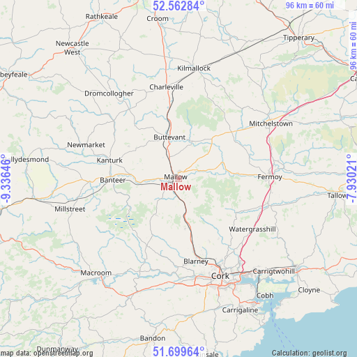
Mallow GPS coordinates[2]
52° 7' 59.988" North, 8° 37' 59.988" West
| Map corner | latitude | longitude |
|---|---|---|
| Upper-left | 52.56284°, | -9.33646° |
| Center: | 52.13333°, | -8.63333° |
| Lower-right: | 51.69964°, | -7.93021° |
| Map W x H: | 96×96 km | = 59.7×59.7mi |
| max Lat: | 55.25° ⇑90.5% North |
| Mallow: | 52.13333° |
| min Lat: | ⇓9.5% South 51.52487° |
| min Long | Mallow | max Long |
| -10.26889° | -8.63333° | -6.04944° |
| W 20.5%⇐ | ⇒79.5% E |
Elevation
Elevation of Mallow is 58 m = 190 ft, and this is 3.5 m = 11 ft above average elevation for this country.
| Max E: |
262 m = 860 ft | 42.3% |
| Mallow | 58 m 190 ft | |
| Avg. | 54.5 m = 179 ft | |
Min E: |
0 m = 0 ft | 57.7% |
See also: Ireland elevation on elevation.city.
Geographical zone
Mallow is located in North temperate zone (between Tropic of Cancer and the Arctic Circle). Distance of this North polar circle is 1604.5 km =997 mi to North.| Distance of | km | miles | from Mallow |
|---|---|---|---|
| North Pole | 4210.4 | 2616.2 | to North |
| Arctic Circle | 1604.5 | 997 | to North |
| Tropic Cancer | 3190.8 | 1982.7 | to South |
| Equator | 5796.7 | 3601.9 | to South |


Nearby cities:
15 places around Mallow: (largest is in red/bold)
• Blarney
22.7 km =14.1 mi,  168°
168°
• Buttevant
11.3 km =7 mi,  348°
348°
• Churchtown
16.3 km =10.1 mi,  335°
335°
• Courtbrack
18.5 km =11.5 mi,  182°
182°
• Doneraile
9.9 km =6.2 mi,  20°
20°
• Drommahane
5.1 km =3.2 mi,  231°
231°
• Fermoy
24.4 km =15.2 mi,  89°
89°
• Glanworth
19.7 km =12.2 mi,  72°
72°
• Grenagh
13.2 km =8.2 mi, 172°
• Kanturk
18.6 km =11.6 mi,  281°
281°
• Rathcormac
24.8 km =15.4 mi,  104°
104°
• Ráth Luirc
24.3 km =15.1 mi, 351°
• Tower
23.1 km =14.4 mi, 175°
• Watergrasshill
24 km =14.9 mi,  124°
124°
• Whitechurch
18.8 km =11.7 mi,  154°
154°
Sources, notices
• [Note1] Compared only with cities in Ireland existing in our database
• [Src1] Map data: © OpenStreetMap contributors (CC-BY-SA)
• [Src2] Other city data from geonames.org with taken over terms of usage.
• [Src3] Geographical zone / Annual Mean Temperature by Robert A. Rohde @ Wikipedia
