Lumding Railway Colony geodata
Lumding Railway Colony (Assam) is a populated place; located in India in Asia/Kolkata (GMT+5.5) time zone. With population of 25,283 people, there are 1682 cities with bigger population in this country. Compared to other cities in India, 68.7% of cities are located further ↓South; 98.1% of cities are located further ←West and 61.3% of cities have higher elevation than Lumding Railway Colony. Note1
Current local time in Lumding Railway Colony:
12:20 PM, WednesdayDifference from your time zone: hours


Lumding Railway Colony GPS coordinates[2]
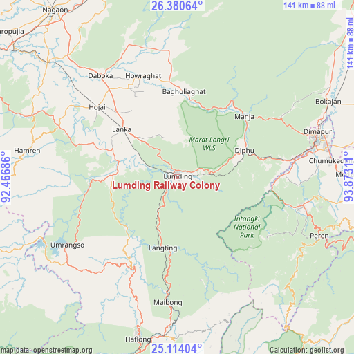
25° 44' 56.508" North, 93° 10' 11.928" East
| Map corner | latitude | longitude |
|---|---|---|
| Upper-left | 26.38064°, | 92.46686° |
| Center: | 25.74903°, | 93.16998° |
| Lower-right: | 25.11404°, | 93.87311° |
| Map W x H: | 140.8×140.8 km | = 87.5×87.5mi |
| max Lat: | 34.9274° ⇑31.3% North |
| Lumding Railway Colony: | 25.74903° |
| min Lat: | ⇓68.7% South 8.09008° |
| min Long | Lumding Railway | max Long |
| 68.82655° | 93.16998° | 96.81° |
| W 98.1%⇐ | ⇒1.9% E |
Elevation
Elevation of Lumding Railway Colony is 141 m = 463 ft, and this is 154.6 m = 507 ft below average elevation for this country.
| Max E: |
3681 m = 12077 ft | 61.3% |
| Avg. | 295.6 m = 970 ft | |
| Lumding Railway Colony | 141 m = 463 ft | |
Min E: |
1 m = 3 ft | 38.7% |
See also: India elevation on elevation.city.
Geographical zone
Lumding Railway Colony is located in North temperate zone (between Tropic of Cancer and the Arctic Circle). Distance of this Northern Tropic circle is 257.1 km =159.8 mi to South.| Distance of | km | miles | from Lumding Railway Colony |
|---|---|---|---|
| North Pole | 7144 | 4439.1 | to North |
| Arctic Circle | 4538.2 | 2819.9 | to North |
| Tropic Cancer | 257.1 | 159.8 | to South |
| Equator | 2863 | 1779 | to South |


Nearby cities:
15 places around Lumding Railway Colony: (largest is in red/bold)
• Barpathār
93.4 km =58 mi,  50°
50°
• Bokajān
68.1 km =42.3 mi,  63°
63°
• Dimāpur
58.1 km =36.1 mi,  71°
71°
• Diphu
28.2 km =17.5 mi, 68°
• Hamren
59.1 km =36.7 mi,  290°
290°
• Hojāi
42.2 km =26.2 mi,  311°
311°
• Hāflong
66.7 km =41.4 mi,  193°
193°
• Khliehriat
91.6 km =56.9 mi,  241°
241°
• Kohima
94.6 km =58.8 mi,  95°
95°
• Kāngpokpi
104.3 km =64.8 mi,  129°
129°
• Mahur
63.2 km =39.3 mi, 185°
• Maibong
49.9 km =31 mi,  183°
183°
• Morigaon
99.2 km =61.6 mi,  304°
304°
• Rahā
84.6 km =52.6 mi, 309°
• Tezpur
105 km =65.2 mi,  339°
339°
Sources, notices
• [Note1] Compared only with cities in India existing in our database
• [Src1] Map data: © OpenStreetMap contributors (CC-BY-SA)
• [Src2] Other city data from geonames.org with taken over terms of usage.
• [Src3] Geographical zone / Annual Mean Temperature by Robert A. Rohde @ Wikipedia
