Bhadrāchalam geodata
Bhadrāchalam (Telangana) is a populated place; located in India in Asia/Kolkata (GMT+5.5) time zone. With population of 45,656 people, there are 969 cities with bigger population in this country. Compared to other cities in India, 72.6% of cities are located further ↑North; 72.6% of cities are located further ←West and 76.5% of cities have higher elevation than Bhadrāchalam. Note1


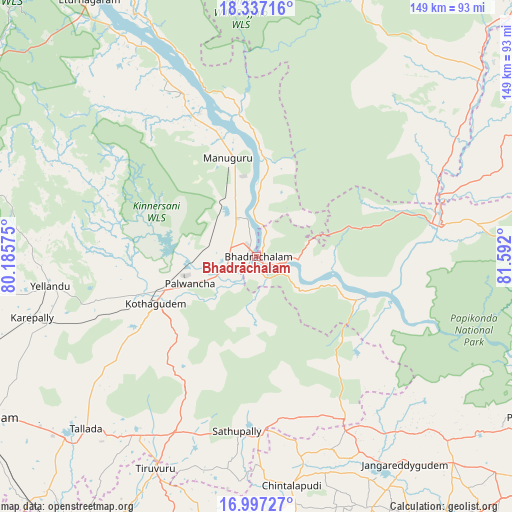
Bhadrāchalam GPS coordinates[2]
17° 40' 6.456" North, 80° 53' 19.932" East
| Map corner | latitude | longitude |
|---|---|---|
| Upper-left | 18.33716°, | 80.18575° |
| Center: | 17.66846°, | 80.88887° |
| Lower-right: | 16.99727°, | 81.592° |
| Map W x H: | 149×149 km | = 92.6×92.6mi |
| max Lat: | 34.9274° ⇑72.6% North |
| Bhadrāchalam: | 17.66846° |
| min Lat: | ⇓27.4% South 8.09008° |
| min Long | Bhadrāchalam | max Long |
| 68.82655° | 80.88887° | 96.81° |
| W 72.6%⇐ | ⇒27.4% E |
Elevation
Elevation of Bhadrāchalam is 61 m = 200 ft, and this is 234.6 m = 770 ft below average elevation for this country.
| Max E: |
3681 m = 12077 ft | 76.5% |
| Avg. | 295.6 m = 970 ft | |
| Bhadrāchalam | 61 m = 200 ft | |
Min E: |
1 m = 3 ft | 23.5% |
See also: Bhadrāchalam elevation on elevation.city.
Geographical zone
Bhadrāchalam is located in North Torrid zone (between Equator and Tropic of Cancer). Distance of this Northern Tropic circle is 641.4 km =398.5 mi to North.| Distance of | km | miles | from Bhadrāchalam |
|---|---|---|---|
| North Pole | 8042.5 | 4997.4 | to North |
| Arctic Circle | 5436.6 | 3378.1 | to North |
| Tropic Cancer | 641.4 | 398.5 | to North |
| Equator | 1964.5 | 1220.7 | to South |


Nearby cities:
15 places around Bhadrāchalam: (largest is in red/bold)
• Chātakonda
28.6 km =17.8 mi,  243°
243°
• Dornakal
82.3 km =51.1 mi,  252°
252°
• Ellore
108.7 km =67.5 mi,  167°
167°
• Gokavaram
111.7 km =69.4 mi,  114°
114°
• Khammam
91.9 km =57.1 mi, 239°
• Kottagūdem
31.6 km =19.6 mi, 245°
• Mahbūbābād
94.3 km =58.6 mi,  265°
265°
• Manuguru
37.5 km =23.3 mi,  337°
337°
• Nūzvīd
97.9 km =60.8 mi,  182°
182°
• Palwancha
24.5 km =15.2 mi, 246°
• Polavaram
92.7 km =57.6 mi,  120°
120°
• Pāloncha
20.8 km =12.9 mi, 249°
• Rampachodavaram
97.3 km =60.5 mi, 105°
• Sathupalli
46.6 km =29 mi, 182°
• Yellandu
60.7 km =37.7 mi,  261°
261°
Sources, notices
• [Note1] Compared only with cities in India existing in our database
• [Src1] Map data: © OpenStreetMap contributors (CC-BY-SA)
• [Src2] Other city data from geonames.org with taken over terms of usage.
• [Src3] Geographical zone / Annual Mean Temperature by Robert A. Rohde @ Wikipedia
