Kamjong geodata
Kamjong (Manipur) is a seat of a second-order administrative division; located in India in Asia/Kolkata (GMT+5.5) time zone. In our database, there are 3475 cities with bigger population. Compared to other cities in India, 62.7% of cities are located further ↓South; 99.1% of cities are located further ←West and 97.9% of cities have lower elevation than Kamjong. Note1


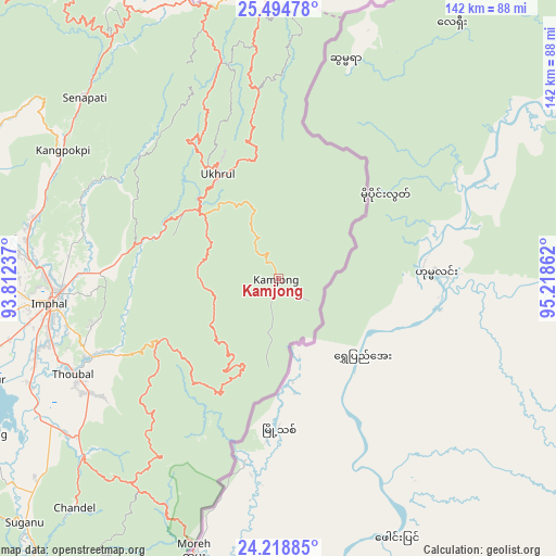
Kamjong GPS coordinates[2]
24° 51' 30.456" North, 94° 30' 55.764" East
| Map corner | latitude | longitude |
|---|---|---|
| Upper-left | 25.49478°, | 93.81237° |
| Center: | 24.85846°, | 94.51549° |
| Lower-right: | 24.21885°, | 95.21862° |
| Map W x H: | 141.9×141.9 km | = 88.2×88.2mi |
| max Lat: | 34.9274° ⇑37.3% North |
| Kamjong: | 24.85846° |
| min Lat: | ⇓62.7% South 8.09008° |
| min Long | Kamjong | max Long |
| 68.82655° | 94.51549° | 96.81° |
| W 99.1%⇐ | ⇒0.90000000000001% E |
Elevation
Elevation of Kamjong is 1564 m = 5131 ft, and this is 1268.4 m = 4161 ft above average elevation for this country.
| Max E: |
3681 m = 12077 ft | 2.1% |
| Kamjong | 1564 m 5131 ft | |
| Avg. | 295.6 m = 970 ft | |
Min E: |
1 m = 3 ft | 97.9% |
See also: India elevation on elevation.city.
Geographical zone
Kamjong is located in North temperate zone (between Tropic of Cancer and the Arctic Circle). Distance of this Northern Tropic circle is 158.1 km =98.2 mi to South.| Distance of | km | miles | from Kamjong |
|---|---|---|---|
| North Pole | 7243.1 | 4500.7 | to North |
| Arctic Circle | 4637.2 | 2881.4 | to North |
| Tropic Cancer | 158.1 | 98.2 | to South |
| Equator | 2764 | 1717.5 | to South |


Nearby cities:
15 places around Kamjong: (largest is in red/bold)
• Bishnupur
80.3 km =49.9 mi,  251°
251°
• Chandel
78.3 km =48.7 mi,  221°
221°
• Churāchāndpur
103.5 km =64.3 mi,  235°
235°
• Imphal
57.9 km =36 mi,  264°
264°
• Kakching
67.2 km =41.8 mi,  233°
233°
• Kohima
99.5 km =61.8 mi,  335°
335°
• Kāngpokpi
63.8 km =39.6 mi,  300°
300°
• Mayāng Imphāl
69.1 km =42.9 mi, 246°
• Moirāng
84.6 km =52.6 mi, 241°
• Phek
89.9 km =55.9 mi,  359°
359°
• Tengnoupal
64.4 km =40 mi, 215°
• Thoubāl
57.8 km =35.9 mi, 245°
• Wāngjing
54.6 km =33.9 mi, 236°
• Yairipok
51.3 km =31.9 mi, 246°
• Zunheboto
123.2 km =76.6 mi,  0°
0°
Sources, notices
• [Note1] Compared only with cities in India existing in our database
• [Src1] Map data: © OpenStreetMap contributors (CC-BY-SA)
• [Src2] Other city data from geonames.org with taken over terms of usage.
• [Src3] Geographical zone / Annual Mean Temperature by Robert A. Rohde @ Wikipedia
