Mayāng Imphāl geodata
Mayāng Imphāl (Manipur) is a populated place; located in India in Asia/Kolkata (GMT+5.5) time zone. With population of 22,159 people, there are 1892 cities with bigger population in this country. Compared to other cities in India, 61.3% of cities are located further ↓South; 98.5% of cities are located further ←West and 93.6% of cities have lower elevation than Mayāng Imphāl. Note1


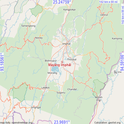
Mayāng Imphāl GPS coordinates[2]
24° 36' 35.928" North, 93° 53' 19.428" East
| Map corner | latitude | longitude |
|---|---|---|
| Upper-left | 25.24759°, | 93.18561° |
| Center: | 24.60998°, | 93.88873° |
| Lower-right: | 23.9691°, | 94.59186° |
| Map W x H: | 142.2×142.2 km | = 88.4×88.4mi |
| max Lat: | 34.9274° ⇑38.7% North |
| Mayāng Imphāl: | 24.60998° |
| min Lat: | ⇓61.3% South 8.09008° |
| min Long | Mayāng Imphāl | max Long |
| 68.82655° | 93.88873° | 96.81° |
| W 98.5%⇐ | ⇒1.5% E |
Elevation
Elevation of Mayāng Imphāl is 777 m = 2549 ft, and this is 481.4 m = 1579 ft above average elevation for this country.
| Max E: |
3681 m = 12077 ft | 6.4% |
| Mayāng Imphāl | 777 m 2549 ft | |
| Avg. | 295.6 m = 970 ft | |
Min E: |
1 m = 3 ft | 93.6% |
See also: India elevation on elevation.city.
Geographical zone
Mayāng Imphāl is located in North temperate zone (between Tropic of Cancer and the Arctic Circle). Distance of this Northern Tropic circle is 130.5 km =81.1 mi to South.| Distance of | km | miles | from Mayāng Imphāl |
|---|---|---|---|
| North Pole | 7270.7 | 4517.8 | to North |
| Arctic Circle | 4664.8 | 2898.6 | to North |
| Tropic Cancer | 130.5 | 81.1 | to South |
| Equator | 2736.4 | 1700.3 | to South |


Nearby cities:
15 places around Mayāng Imphāl: (largest is in red/bold)
• Bishnupur
13 km =8.1 mi,  279°
279°
• Chandel
33.3 km =20.7 mi,  159°
159°
• Churāchāndpur
37.9 km =23.5 mi,  215°
215°
• Imphal
22.7 km =14.1 mi,  14°
14°
• Jiribam
80.5 km =50 mi,  285°
285°
• Kakching
15.6 km =9.7 mi,  143°
143°
• Kamjong
69.1 km =42.9 mi,  66°
66°
• Kāngpokpi
60.9 km =37.8 mi, 7°
• Lakhipur
91.2 km =56.7 mi, 282°
• Moirāng
16.8 km =10.4 mi, 221°
• Pherzawl
80.7 km =50.1 mi,  241°
241°
• Tengnoupal
36.2 km =22.5 mi,  133°
133°
• Thoubāl
11.3 km =7 mi, 73°
• Wāngjing
17.9 km =11.1 mi,  97°
97°
• Yairipok
17.8 km =11.1 mi,  64°
64°
Sources, notices
• [Note1] Compared only with cities in India existing in our database
• [Src1] Map data: © OpenStreetMap contributors (CC-BY-SA)
• [Src2] Other city data from geonames.org with taken over terms of usage.
• [Src3] Geographical zone / Annual Mean Temperature by Robert A. Rohde @ Wikipedia
