Wai geodata
Wai (Maharashtra) is a populated place; located in India in Asia/Kolkata (GMT+5.5) time zone. With population of 32,957 people, there are 1319 cities with bigger population in this country. Compared to other cities in India, 71.9% of cities are located further ↑North; 90.4% of cities are located further →East and 92.5% of cities have lower elevation than Wai. Note1


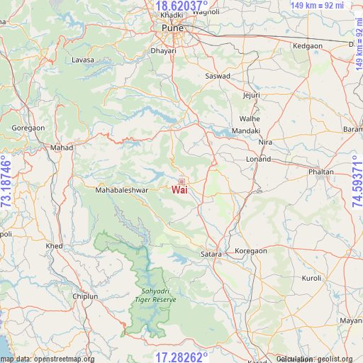
Wai GPS coordinates[2]
17° 57' 9.936" North, 73° 53' 26.088" East
| Map corner | latitude | longitude |
|---|---|---|
| Upper-left | 18.62037°, | 73.18746° |
| Center: | 17.95276°, | 73.89058° |
| Lower-right: | 17.28262°, | 74.59371° |
| Map W x H: | 148.7×148.7 km | = 92.4×92.4mi |
| max Lat: | 34.9274° ⇑71.9% North |
| Wai: | 17.95276° |
| min Lat: | ⇓28.1% South 8.09008° |
| min Long | Wai | max Long |
| 68.82655° | 73.89058° | 96.81° |
| W 9.6%⇐ | ⇒90.4% E |
Elevation
Elevation of Wai is 710 m = 2329 ft, and this is 414.4 m = 1360 ft above average elevation for this country.
| Max E: |
3681 m = 12077 ft | 7.5% |
| Wai | 710 m 2329 ft | |
| Avg. | 295.6 m = 970 ft | |
Min E: |
1 m = 3 ft | 92.5% |
See also: India elevation on elevation.city.
Geographical zone
Wai is located in North Torrid zone (between Equator and Tropic of Cancer). Distance of this Northern Tropic circle is 609.8 km =378.9 mi to North.| Distance of | km | miles | from Wai |
|---|---|---|---|
| North Pole | 8010.9 | 4977.7 | to North |
| Arctic Circle | 5405 | 3358.5 | to North |
| Tropic Cancer | 609.8 | 378.9 | to North |
| Equator | 1996.2 | 1240.4 | to South |


Nearby cities:
15 places around Wai: (largest is in red/bold)
• Bhor
22.3 km =13.9 mi,  347°
347°
• Chiplūn
61.7 km =38.3 mi,  220°
220°
• Jejūri
45.9 km =28.5 mi,  38°
38°
• Kharakvasla
55.5 km =34.5 mi, 347°
• Khed
43.1 km =26.8 mi, 353°
• Khed
58.4 km =36.3 mi,  243°
243°
• Koynanagar
62.8 km =39 mi,  192°
192°
• Mahād
52.2 km =32.4 mi,  286°
286°
• Phaltan
57.4 km =35.7 mi,  85°
85°
• Pune
63.1 km =39.2 mi,  356°
356°
• Pānchgani
10 km =6.2 mi,  251°
251°
• Rahimatpur
51.8 km =32.2 mi,  140°
140°
• Satara
31.6 km =19.6 mi,  159°
159°
• Shirwal
23.9 km =14.9 mi,  22°
22°
• Sāsvad
45.9 km =28.5 mi, 18°
Sources, notices
• [Note1] Compared only with cities in India existing in our database
• [Src1] Map data: © OpenStreetMap contributors (CC-BY-SA)
• [Src2] Other city data from geonames.org with taken over terms of usage.
• [Src3] Geographical zone / Annual Mean Temperature by Robert A. Rohde @ Wikipedia
