Tuljāpur geodata
Tuljāpur (Maharashtra) is a populated place; located in India in Asia/Kolkata (GMT+5.5) time zone. With population of 35,596 people, there are 1218 cities with bigger population in this country. Compared to other cities in India, 71.8% of cities are located further ↑North; 72.9% of cities are located further →East and 90.7% of cities have lower elevation than Tuljāpur. Note1


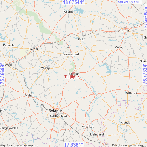
Tuljāpur GPS coordinates[2]
18° 0' 28.944" North, 76° 4' 12.396" East
| Map corner | latitude | longitude |
|---|---|---|
| Upper-left | 18.67544°, | 75.36699° |
| Center: | 18.00804°, | 76.07011° |
| Lower-right: | 17.3381°, | 76.77324° |
| Map W x H: | 148.7×148.7 km | = 92.4×92.4mi |
| max Lat: | 34.9274° ⇑71.8% North |
| Tuljāpur: | 18.00804° |
| min Lat: | ⇓28.2% South 8.09008° |
| min Long | Tuljāpur | max Long |
| 68.82655° | 76.07011° | 96.81° |
| W 27.1%⇐ | ⇒72.9% E |
Elevation
Elevation of Tuljāpur is 647 m = 2123 ft, and this is 351.4 m = 1153 ft above average elevation for this country.
| Max E: |
3681 m = 12077 ft | 9.3% |
| Tuljāpur | 647 m 2123 ft | |
| Avg. | 295.6 m = 970 ft | |
Min E: |
1 m = 3 ft | 90.7% |
See also: India elevation on elevation.city.
Geographical zone
Tuljāpur is located in North Torrid zone (between Equator and Tropic of Cancer). Distance of this Northern Tropic circle is 603.6 km =375.1 mi to North.| Distance of | km | miles | from Tuljāpur |
|---|---|---|---|
| North Pole | 8004.8 | 4974 | to North |
| Arctic Circle | 5398.9 | 3354.7 | to North |
| Tropic Cancer | 603.6 | 375.1 | to North |
| Equator | 2002.3 | 1244.2 | to South |


Nearby cities:
15 places around Tuljāpur: (largest is in red/bold)
• Akalkot
55.6 km =34.5 mi,  164°
164°
• Aland
72.2 km =44.9 mi,  133°
133°
• Ausa
52.6 km =32.7 mi,  59°
59°
• Bhūm
66.3 km =41.2 mi,  319°
319°
• Bārsi
47.2 km =29.3 mi,  302°
302°
• Kurduvādi
69.8 km =43.4 mi,  277°
277°
• Kāti
19.8 km =12.3 mi,  254°
254°
• Latur
68.1 km =42.3 mi,  50°
50°
• Maindargi
65.6 km =40.8 mi, 158°
• Moram
48.9 km =30.4 mi,  119°
119°
• Naldurg
30.9 km =19.2 mi, 133°
• Nilanga
73.2 km =45.5 mi,  80°
80°
• Osmanabad
19.6 km =12.2 mi,  350°
350°
• Solāpur
41.1 km =25.5 mi,  204°
204°
• Umarga
61.5 km =38.2 mi,  107°
107°
Sources, notices
• [Note1] Compared only with cities in India existing in our database
• [Src1] Map data: © OpenStreetMap contributors (CC-BY-SA)
• [Src2] Other city data from geonames.org with taken over terms of usage.
• [Src3] Geographical zone / Annual Mean Temperature by Robert A. Rohde @ Wikipedia
