Tīkamgarh geodata
Tīkamgarh (Madhya Pradesh) is a populated place; located in India in Asia/Kolkata (GMT+5.5) time zone. With population of 74,724 people, there are 587 cities with bigger population in this country. Compared to other cities in India, 62% of cities are located further ↓South; 57.4% of cities are located further ←West and 72.8% of cities have lower elevation than Tīkamgarh. Note1


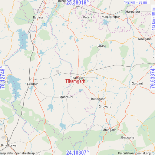
Tīkamgarh GPS coordinates[2]
24° 44' 35.772" North, 78° 49' 50.196" East
| Map corner | latitude | longitude |
|---|---|---|
| Upper-left | 25.38019°, | 78.12749° |
| Center: | 24.74327°, | 78.83061° |
| Lower-right: | 24.10307°, | 79.53374° |
| Map W x H: | 142×142 km | = 88.2×88.2mi |
| max Lat: | 34.9274° ⇑38% North |
| Tīkamgarh: | 24.74327° |
| min Lat: | ⇓62% South 8.09008° |
| min Long | Tīkamgarh | max Long |
| 68.82655° | 78.83061° | 96.81° |
| W 57.4%⇐ | ⇒42.6% E |
Elevation
Elevation of Tīkamgarh is 360 m = 1181 ft, and this is 64.4 m = 211 ft above average elevation for this country.
| Max E: |
3681 m = 12077 ft | 27.2% |
| Tīkamgarh | 360 m 1181 ft | |
| Avg. | 295.6 m = 970 ft | |
Min E: |
1 m = 3 ft | 72.8% |
See also: Tīkamgarh elevation on elevation.city.
Geographical zone
Tīkamgarh is located in North temperate zone (between Tropic of Cancer and the Arctic Circle). Distance of this Northern Tropic circle is 145.3 km =90.3 mi to South.| Distance of | km | miles | from Tīkamgarh |
|---|---|---|---|
| North Pole | 7255.9 | 4508.6 | to North |
| Arctic Circle | 4650 | 2889.4 | to North |
| Tropic Cancer | 145.3 | 90.3 | to South |
| Equator | 2751.2 | 1709.5 | to South |


Nearby cities:
15 places around Tīkamgarh: (largest is in red/bold)
• Babīna
66.1 km =41.1 mi,  326°
326°
• Baldeogarh
23.9 km =14.9 mi,  86°
86°
• Bijāwar
67.9 km =42.2 mi,  101°
101°
• Bāmor Kalān
70.6 km =43.9 mi,  283°
283°
• Chanderi
70 km =43.5 mi,  267°
267°
• Jatāra
36.9 km =22.9 mi,  36°
36°
• Khargāpur
32.9 km =20.4 mi,  74°
74°
• Lalitpur
42 km =26.1 mi,  261°
261°
• Mahroni
20.3 km =12.6 mi,  210°
210°
• Orchha
70.3 km =43.7 mi,  344°
344°
• Palera
50.6 km =31.4 mi,  52°
52°
• Pāli
50.4 km =31.3 mi,  236°
236°
• Rānīpur
61 km =37.9 mi,  22°
22°
• Shāhgarh
55.9 km =34.7 mi,  148°
148°
• Tālbahat
52.1 km =32.4 mi,  309°
309°
Sources, notices
• [Note1] Compared only with cities in India existing in our database
• [Src1] Map data: © OpenStreetMap contributors (CC-BY-SA)
• [Src2] Other city data from geonames.org with taken over terms of usage.
• [Src3] Geographical zone / Annual Mean Temperature by Robert A. Rohde @ Wikipedia
