Mehndāwal geodata
Mehndāwal (Uttar Pradesh) is a populated place; located in India in Asia/Kolkata (GMT+5.5) time zone. With population of 25,495 people, there are 1667 cities with bigger population in this country. Compared to other cities in India, 78.2% of cities are located further ↓South; 79.6% of cities are located further ←West and 71% of cities have higher elevation than Mehndāwal. Note1


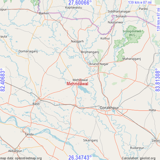
Mehndāwal GPS coordinates[2]
26° 58' 32.844" North, 83° 6' 35.82" East
| Map corner | latitude | longitude |
|---|---|---|
| Upper-left | 27.60066°, | 82.40683° |
| Center: | 26.97579°, | 83.10995° |
| Lower-right: | 26.34743°, | 83.81308° |
| Map W x H: | 139.3×139.3 km | = 86.6×86.6mi |
| max Lat: | 34.9274° ⇑21.8% North |
| Mehndāwal: | 26.97579° |
| min Lat: | ⇓78.2% South 8.09008° |
| min Long | Mehndāwal | max Long |
| 68.82655° | 83.10995° | 96.81° |
| W 79.6%⇐ | ⇒20.4% E |
Elevation
Elevation of Mehndāwal is 88 m = 289 ft, and this is 207.6 m = 681 ft below average elevation for this country.
| Max E: |
3681 m = 12077 ft | 71% |
| Avg. | 295.6 m = 970 ft | |
| Mehndāwal | 88 m = 289 ft | |
Min E: |
1 m = 3 ft | 29% |
See also: India elevation on elevation.city.
Geographical zone
Mehndāwal is located in North temperate zone (between Tropic of Cancer and the Arctic Circle). Distance of this Northern Tropic circle is 393.5 km =244.5 mi to South.| Distance of | km | miles | from Mehndāwal |
|---|---|---|---|
| North Pole | 7007.6 | 4354.3 | to North |
| Arctic Circle | 4401.7 | 2735.1 | to North |
| Tropic Cancer | 393.5 | 244.5 | to South |
| Equator | 2999.4 | 1863.7 | to South |


Nearby cities:
15 places around Mehndāwal: (largest is in red/bold)
• Anandnagar
21.2 km =13.2 mi,  49°
49°
• Bastī
44.3 km =27.5 mi,  241°
241°
• Bānsgāon
52.8 km =32.8 mi,  153°
153°
• Bānsi
28.4 km =17.6 mi,  322°
322°
• Captainganj
60.1 km =37.3 mi,  95°
95°
• Gorakhpur
34.7 km =21.6 mi,  132°
132°
• Haraiya
67.1 km =41.7 mi,  252°
252°
• Hātā
68.2 km =42.4 mi,  112°
112°
• Khalīlābād
22.9 km =14.2 mi,  189°
189°
• Maghar
24.5 km =15.2 mi,  175°
175°
• Mahārāganj
48.5 km =30.1 mi,  67°
67°
• Nautanwa
58.7 km =36.5 mi,  31°
31°
• Pipraich
44.5 km =27.7 mi, 111°
• Siswā Bāzār
66.9 km =41.6 mi, 73°
• Tāndā
65.2 km =40.5 mi,  223°
223°
Sources, notices
• [Note1] Compared only with cities in India existing in our database
• [Src1] Map data: © OpenStreetMap contributors (CC-BY-SA)
• [Src2] Other city data from geonames.org with taken over terms of usage.
• [Src3] Geographical zone / Annual Mean Temperature by Robert A. Rohde @ Wikipedia
