Shāhpur geodata
Shāhpur (Madhya Pradesh) is a populated place; located in India in Asia/Kolkata (GMT+5.5) time zone. With population of 9,394 people, there are 3004 cities with bigger population in this country. Compared to other cities in India, 51.9% of cities are located further ↓South; 73% of cities are located further ←West and 92.9% of cities have lower elevation than Shāhpur. Note1


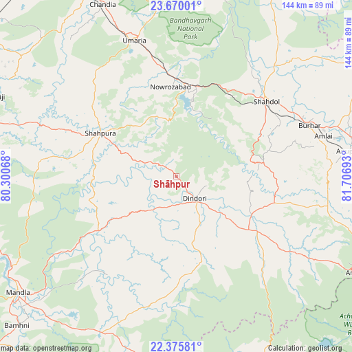
Shāhpur GPS coordinates[2]
23° 1' 28.056" North, 81° 0' 13.68" East
| Map corner | latitude | longitude |
|---|---|---|
| Upper-left | 23.67001°, | 80.30068° |
| Center: | 23.02446°, | 81.0038° |
| Lower-right: | 22.37581°, | 81.70693° |
| Map W x H: | 143.9×143.9 km | = 89.4×89.4mi |
| max Lat: | 34.9274° ⇑48.1% North |
| Shāhpur: | 23.02446° |
| min Lat: | ⇓51.9% South 8.09008° |
| min Long | Shāhpur | max Long |
| 68.82655° | 81.0038° | 96.81° |
| W 73%⇐ | ⇒27% E |
Elevation
Elevation of Shāhpur is 736 m = 2415 ft, and this is 440.4 m = 1445 ft above average elevation for this country.
| Max E: |
3681 m = 12077 ft | 7.1% |
| Shāhpur | 736 m 2415 ft | |
| Avg. | 295.6 m = 970 ft | |
Min E: |
1 m = 3 ft | 92.9% |
See also: India elevation on elevation.city.
Geographical zone
Shāhpur is located in North Torrid zone (between Equator and Tropic of Cancer). Distance of this Northern Tropic circle is 45.8 km =28.5 mi to North.| Distance of | km | miles | from Shāhpur |
|---|---|---|---|
| North Pole | 7447 | 4627.3 | to North |
| Arctic Circle | 4841.1 | 3008.1 | to North |
| Tropic Cancer | 45.8 | 28.5 | to North |
| Equator | 2560.1 | 1590.8 | to South |


Nearby cities:
15 places around Shāhpur: (largest is in red/bold)
• Amarkantak
86.6 km =53.8 mi,  116°
116°
• Anūppur
70.8 km =44 mi,  82°
82°
• Barela
97.8 km =60.8 mi,  274°
274°
• Bodri
46.6 km =29 mi,  70°
70°
• Burhar
58 km =36 mi, 68°
• Chandia
76.4 km =47.5 mi,  336°
336°
• Dindori
12.1 km =7.5 mi,  139°
139°
• Gaurela
96.7 km =60.1 mi,  108°
108°
• Jaisinghnagar
83.5 km =51.9 mi,  28°
28°
• Mandlā
80.3 km =49.9 mi,  233°
233°
• Pandaria
98.2 km =61 mi,  154°
154°
• Pāli
38 km =23.6 mi,  6°
6°
• Pāndātarai
98.9 km =61.5 mi,  160°
160°
• Shahdol
47.3 km =29.4 mi,  50°
50°
• Umaria
58.2 km =36.2 mi, 342°
Sources, notices
• [Note1] Compared only with cities in India existing in our database
• [Src1] Map data: © OpenStreetMap contributors (CC-BY-SA)
• [Src2] Other city data from geonames.org with taken over terms of usage.
• [Src3] Geographical zone / Annual Mean Temperature by Robert A. Rohde @ Wikipedia
