Seoni geodata
Seoni (Himachal Pradesh) is a populated place; located in India in Asia/Kolkata (GMT+5.5) time zone. With population of 1,630 people, there are 3446 cities with bigger population in this country. Compared to other cities in India, 96.5% of cities are located further ↓South; 61.8% of cities are located further →East and 91.5% of cities have lower elevation than Seoni. Note1


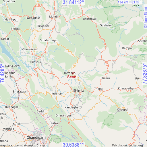
Seoni GPS coordinates[2]
31° 14' 30.768" North, 77° 7' 25.032" East
| Map corner | latitude | longitude |
|---|---|---|
| Upper-left | 31.84112°, | 76.4205° |
| Center: | 31.24188°, | 77.12362° |
| Lower-right: | 30.63881°, | 77.82675° |
| Map W x H: | 133.7×133.7 km | = 83.1×83.1mi |
| max Lat: | 34.9274° ⇑3.5% North |
| Seoni: | 31.24188° |
| min Lat: | ⇓96.5% South 8.09008° |
| min Long | Seoni | max Long |
| 68.82655° | 77.12362° | 96.81° |
| W 38.2%⇐ | ⇒61.8% E |
Elevation
Elevation of Seoni is 668 m = 2192 ft, and this is 372.4 m = 1222 ft above average elevation for this country.
| Max E: |
3681 m = 12077 ft | 8.5% |
| Seoni | 668 m 2192 ft | |
| Avg. | 295.6 m = 970 ft | |
Min E: |
1 m = 3 ft | 91.5% |
See also: India elevation on elevation.city.
Geographical zone
Seoni is located in North temperate zone (between Tropic of Cancer and the Arctic Circle). Distance of this Northern Tropic circle is 867.9 km =539.3 mi to South.| Distance of | km | miles | from Seoni |
|---|---|---|---|
| North Pole | 6533.3 | 4059.6 | to North |
| Arctic Circle | 3927.4 | 2440.4 | to North |
| Tropic Cancer | 867.9 | 539.3 | to South |
| Equator | 3473.8 | 2158.5 | to South |


Nearby cities:
15 places around Seoni: (largest is in red/bold)
• Arki
18 km =11.2 mi,  236°
236°
• Baddi
44.7 km =27.8 mi,  225°
225°
• Bilaspur
36.2 km =22.5 mi,  285°
285°
• Dagshai
40.3 km =25 mi,  189°
189°
• Ghumārwīn
44.7 km =27.8 mi,  299°
299°
• Jutogh
15.8 km =9.8 mi,  182°
182°
• Kasauli
41 km =25.5 mi,  201°
201°
• Kotkhai
41.9 km =26 mi,  109°
109°
• Nālāgarh
44.2 km =27.5 mi, 239°
• Nārkanda
32.1 km =19.9 mi,  86°
86°
• Sabāthu
32.2 km =20 mi, 202°
• Shimla
15.8 km =9.8 mi,  165°
165°
• Solan
37 km =23 mi, 182°
• Sundarnagar
38.7 km =24 mi,  327°
327°
• Theog
26 km =16.2 mi,  120°
120°
Sources, notices
• [Note1] Compared only with cities in India existing in our database
• [Src1] Map data: © OpenStreetMap contributors (CC-BY-SA)
• [Src2] Other city data from geonames.org with taken over terms of usage.
• [Src3] Geographical zone / Annual Mean Temperature by Robert A. Rohde @ Wikipedia
