Jutogh geodata
Jutogh (Himachal Pradesh) is a populated place; located in India in Asia/Kolkata (GMT+5.5) time zone. With population of 2,467 people, there are 3425 cities with bigger population in this country. Compared to other cities in India, 96% of cities are located further ↓South; 61.8% of cities are located further →East and 98.9% of cities have lower elevation than Jutogh. Note1


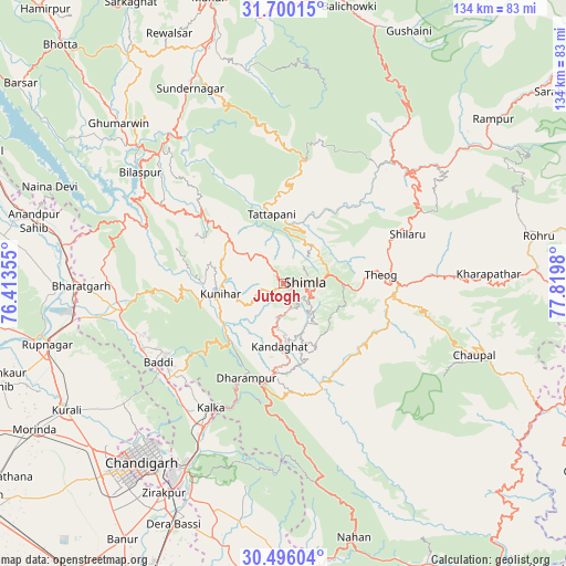
Jutogh GPS coordinates[2]
31° 6' 0" North, 77° 7' 0.012" East
| Map corner | latitude | longitude |
|---|---|---|
| Upper-left | 31.70015°, | 76.41355° |
| Center: | 31.1°, | 77.11667° |
| Lower-right: | 30.49604°, | 77.8198° |
| Map W x H: | 133.9×133.9 km | = 83.2×83.2mi |
| max Lat: | 34.9274° ⇑4% North |
| Jutogh: | 31.1° |
| min Lat: | ⇓96% South 8.09008° |
| min Long | Jutogh | max Long |
| 68.82655° | 77.11667° | 96.81° |
| W 38.2%⇐ | ⇒61.8% E |
Elevation
Elevation of Jutogh is 1785 m = 5856 ft, and this is 1489.4 m = 4886 ft above average elevation for this country.
| Max E: |
3681 m = 12077 ft | 1.1% |
| Jutogh | 1785 m 5856 ft | |
| Avg. | 295.6 m = 970 ft | |
Min E: |
1 m = 3 ft | 98.9% |
See also: India elevation on elevation.city.
Geographical zone
Jutogh is located in North temperate zone (between Tropic of Cancer and the Arctic Circle). Distance of this Northern Tropic circle is 852.1 km =529.5 mi to South.| Distance of | km | miles | from Jutogh |
|---|---|---|---|
| North Pole | 6549.1 | 4069.4 | to North |
| Arctic Circle | 3943.2 | 2450.2 | to North |
| Tropic Cancer | 852.1 | 529.5 | to South |
| Equator | 3458 | 2148.7 | to South |


Nearby cities:
15 places around Jutogh: (largest is in red/bold)
• Arki
15.4 km =9.6 mi,  292°
292°
• Baddi
34.8 km =21.6 mi,  242°
242°
• Dagshai
24.8 km =15.4 mi,  194°
194°
• Kasauli
26.6 km =16.5 mi,  212°
212°
• Kālka
33.4 km =20.8 mi, 210°
• Nālāgarh
38.1 km =23.7 mi,  260°
260°
• Nārkanda
37.1 km =23.1 mi,  61°
61°
• Parwanoo
32.8 km =20.4 mi, 206°
• Pinjaur
38.5 km =23.9 mi, 209°
• Rājgarh
32.7 km =20.3 mi,  147°
147°
• Sabāthu
18.3 km =11.4 mi,  220°
220°
• Seoni
15.8 km =9.8 mi,  2°
2°
• Shimla
4.8 km =3 mi,  84°
84°
• Solan
21.2 km =13.2 mi,  182°
182°
• Theog
23.1 km =14.4 mi, 84°
Sources, notices
• [Note1] Compared only with cities in India existing in our database
• [Src1] Map data: © OpenStreetMap contributors (CC-BY-SA)
• [Src2] Other city data from geonames.org with taken over terms of usage.
• [Src3] Geographical zone / Annual Mean Temperature by Robert A. Rohde @ Wikipedia
