Jintūr geodata
Jintūr (Maharashtra) is a populated place; located in India in Asia/Kolkata (GMT+5.5) time zone. With population of 42,420 people, there are 1040 cities with bigger population in this country. Compared to other cities in India, 66.6% of cities are located further ↑North; 66.4% of cities are located further →East and 78.7% of cities have lower elevation than Jintūr. Note1


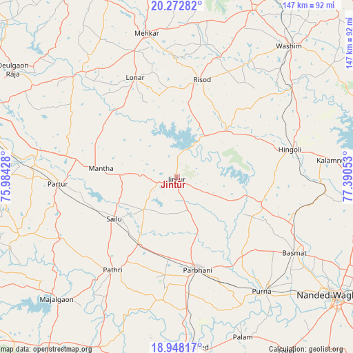
Jintūr GPS coordinates[2]
19° 36' 42.696" North, 76° 41' 14.64" East
| Map corner | latitude | longitude |
|---|---|---|
| Upper-left | 20.27282°, | 75.98428° |
| Center: | 19.61186°, | 76.6874° |
| Lower-right: | 18.94817°, | 77.39053° |
| Map W x H: | 147.3×147.3 km | = 91.5×91.5mi |
| max Lat: | 34.9274° ⇑66.6% North |
| Jintūr: | 19.61186° |
| min Lat: | ⇓33.4% South 8.09008° |
| min Long | Jintūr | max Long |
| 68.82655° | 76.6874° | 96.81° |
| W 33.6%⇐ | ⇒66.4% E |
Elevation
Elevation of Jintūr is 442 m = 1450 ft, and this is 146.4 m = 480 ft above average elevation for this country.
| Max E: |
3681 m = 12077 ft | 21.3% |
| Jintūr | 442 m 1450 ft | |
| Avg. | 295.6 m = 970 ft | |
Min E: |
1 m = 3 ft | 78.7% |
See also: Jintūr elevation on elevation.city.
Geographical zone
Jintūr is located in North Torrid zone (between Equator and Tropic of Cancer). Distance of this Northern Tropic circle is 425.3 km =264.3 mi to North.| Distance of | km | miles | from Jintūr |
|---|---|---|---|
| North Pole | 7826.4 | 4863.1 | to North |
| Arctic Circle | 5220.5 | 3243.9 | to North |
| Tropic Cancer | 425.3 | 264.3 | to North |
| Equator | 2180.6 | 1355 | to South |


Nearby cities:
15 places around Jintūr: (largest is in red/bold)
• Ashti
55.1 km =34.2 mi,  241°
241°
• Basmat
58.5 km =36.4 mi,  122°
122°
• Gangākher
71.7 km =44.6 mi,  174°
174°
• Hingoli
49 km =30.4 mi,  76°
76°
• Kalamnūri
65.7 km =40.8 mi, 83°
• Lonār
45 km =28 mi,  337°
337°
• Mehekar
61.2 km =38 mi,  348°
348°
• Mājalgaon
71.1 km =44.2 mi,  224°
224°
• Mānwat
39.9 km =24.8 mi,  209°
209°
• Parbhani
39.2 km =24.4 mi, 167°
• Partūr
49.5 km =30.8 mi,  268°
268°
• Pāthri
47.4 km =29.5 mi, 214°
• Pūrna
59.5 km =37 mi,  143°
143°
• Risod
41.9 km =26 mi,  14°
14°
• Selu
31.2 km =19.4 mi, 236°
Sources, notices
• [Note1] Compared only with cities in India existing in our database
• [Src1] Map data: © OpenStreetMap contributors (CC-BY-SA)
• [Src2] Other city data from geonames.org with taken over terms of usage.
• [Src3] Geographical zone / Annual Mean Temperature by Robert A. Rohde @ Wikipedia
