Mothīhāri geodata
Mothīhāri (Bihar) is a populated place; located in India in Asia/Kolkata (GMT+5.5) time zone. With population of 112,144 people, there are 392 cities with bigger population in this country. Compared to other cities in India, 75.8% of cities are located further ↓South; 84.1% of cities are located further ←West and 73.8% of cities have higher elevation than Mothīhāri. Note1


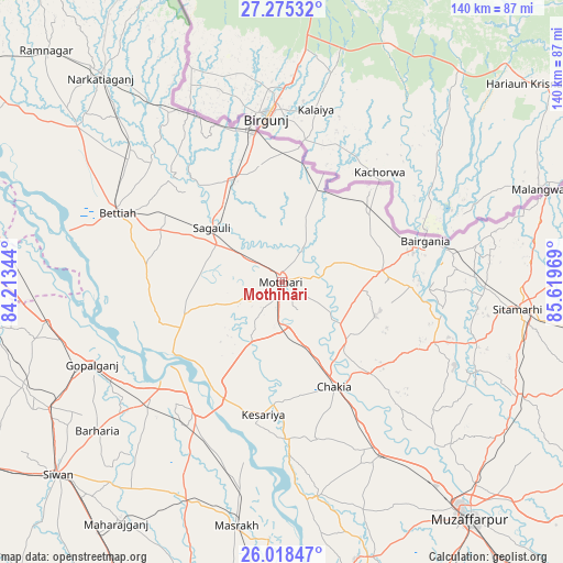
Mothīhāri GPS coordinates[2]
26° 38' 55.032" North, 84° 54' 59.616" East
| Map corner | latitude | longitude |
|---|---|---|
| Upper-left | 27.27532°, | 84.21344° |
| Center: | 26.64862°, | 84.91656° |
| Lower-right: | 26.01847°, | 85.61969° |
| Map W x H: | 139.7×139.8 km | = 86.8×86.9mi |
| max Lat: | 34.9274° ⇑24.2% North |
| Mothīhāri: | 26.64862° |
| min Lat: | ⇓75.8% South 8.09008° |
| min Long | Mothīhāri | max Long |
| 68.82655° | 84.91656° | 96.81° |
| W 84.1%⇐ | ⇒15.9% E |
Elevation
Elevation of Mothīhāri is 74 m = 243 ft, and this is 221.6 m = 727 ft below average elevation for this country.
| Max E: |
3681 m = 12077 ft | 73.8% |
| Avg. | 295.6 m = 970 ft | |
| Mothīhāri | 74 m = 243 ft | |
Min E: |
1 m = 3 ft | 26.2% |
See also: Mothīhāri elevation on elevation.city.
Geographical zone
Mothīhāri is located in North temperate zone (between Tropic of Cancer and the Arctic Circle). Distance of this Northern Tropic circle is 357.1 km =221.9 mi to South.| Distance of | km | miles | from Mothīhāri |
|---|---|---|---|
| North Pole | 7044 | 4376.9 | to North |
| Arctic Circle | 4438.1 | 2757.7 | to North |
| Tropic Cancer | 357.1 | 221.9 | to South |
| Equator | 2963 | 1841.1 | to South |


Nearby cities:
15 places around Mothīhāri: (largest is in red/bold)
• Bairāgnia
36.9 km =22.9 mi,  73°
73°
• Barauli
44.3 km =27.5 mi,  227°
227°
• Belsand
53.3 km =33.1 mi,  115°
115°
• Bettiah
44.5 km =27.7 mi,  292°
292°
• Chākia
28.9 km =18 mi,  153°
153°
• Dhāka
25.1 km =15.6 mi,  83°
83°
• Dumra
60.7 km =37.7 mi,  98°
98°
• Gopālganj
51.5 km =32 mi,  246°
246°
• Mahārājgani
72.6 km =45.1 mi,  214°
214°
• Muzaffarpur
75.2 km =46.7 mi,  141°
141°
• Raxaul
37.4 km =23.2 mi,  349°
349°
• Sagauli
21.4 km =13.3 mi,  306°
306°
• Sheohar
40.4 km =25.1 mi,  111°
111°
• Siwān
73.3 km =45.5 mi, 229°
• Sītāmarhi
57.4 km =35.7 mi, 96°
Sources, notices
• [Note1] Compared only with cities in India existing in our database
• [Src1] Map data: © OpenStreetMap contributors (CC-BY-SA)
• [Src2] Other city data from geonames.org with taken over terms of usage.
• [Src3] Geographical zone / Annual Mean Temperature by Robert A. Rohde @ Wikipedia
