Rāghogarh geodata
Rāghogarh (Madhya Pradesh) is a populated place; located in India in Asia/Kolkata (GMT+5.5) time zone. With population of 63,873 people, there are 692 cities with bigger population in this country. Compared to other cities in India, 60.3% of cities are located further ↓South; 61.1% of cities are located further →East and 78.9% of cities have lower elevation than Rāghogarh. Note1


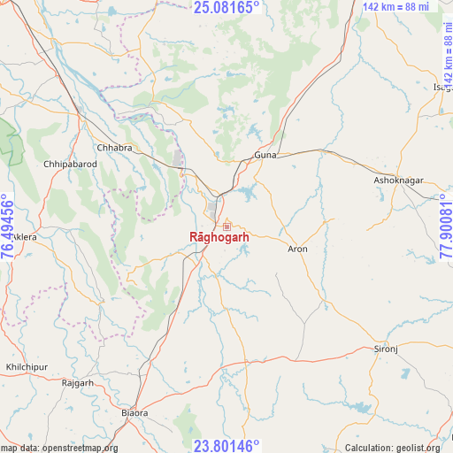
Rāghogarh GPS coordinates[2]
24° 26' 35.448" North, 77° 11' 51.648" East
| Map corner | latitude | longitude |
|---|---|---|
| Upper-left | 25.08165°, | 76.49456° |
| Center: | 24.44318°, | 77.19768° |
| Lower-right: | 23.80146°, | 77.90081° |
| Map W x H: | 142.3×142.3 km | = 88.4×88.4mi |
| max Lat: | 34.9274° ⇑39.7% North |
| Rāghogarh: | 24.44318° |
| min Lat: | ⇓60.3% South 8.09008° |
| min Long | Rāghogarh | max Long |
| 68.82655° | 77.19768° | 96.81° |
| W 38.9%⇐ | ⇒61.1% E |
Elevation
Elevation of Rāghogarh is 444 m = 1457 ft, and this is 148.4 m = 487 ft above average elevation for this country.
| Max E: |
3681 m = 12077 ft | 21.1% |
| Rāghogarh | 444 m 1457 ft | |
| Avg. | 295.6 m = 970 ft | |
Min E: |
1 m = 3 ft | 78.9% |
See also: Rāghogarh elevation on elevation.city.
Geographical zone
Rāghogarh is located in North temperate zone (between Tropic of Cancer and the Arctic Circle). Distance of this Northern Tropic circle is 111.9 km =69.5 mi to South.| Distance of | km | miles | from Rāghogarh |
|---|---|---|---|
| North Pole | 7289.2 | 4529.3 | to North |
| Arctic Circle | 4683.3 | 2910.1 | to North |
| Tropic Cancer | 111.9 | 69.5 | to South |
| Equator | 2717.8 | 1688.8 | to South |


Nearby cities:
15 places around Rāghogarh: (largest is in red/bold)
• Aklera
63.9 km =39.7 mi,  266°
266°
• Ashoknagar
56 km =34.8 mi,  74°
74°
• Biaora
65 km =40.4 mi,  206°
206°
• Chandpura
66.4 km =41.3 mi,  171°
171°
• Chhabra
43.4 km =27 mi,  304°
304°
• Garha Brahman
65.9 km =40.9 mi, 165°
• Guna
25.4 km =15.8 mi,  26°
26°
• Khata Khedi
64.2 km =39.9 mi, 171°
• Kumbhrāj
17 km =10.6 mi,  242°
242°
• Leteri
47.7 km =29.6 mi,  153°
153°
• Manohar Thāna
46 km =28.6 mi, 240°
• Patalpani
68.8 km =42.8 mi, 166°
• Rājgarh
67.6 km =42 mi,  224°
224°
• Sironj
62.7 km =39 mi,  127°
127°
• Āron
23.3 km =14.5 mi,  107°
107°
Sources, notices
• [Note1] Compared only with cities in India existing in our database
• [Src1] Map data: © OpenStreetMap contributors (CC-BY-SA)
• [Src2] Other city data from geonames.org with taken over terms of usage.
• [Src3] Geographical zone / Annual Mean Temperature by Robert A. Rohde @ Wikipedia
