Pulivendla geodata
Pulivendla (Andhra Pradesh) is a populated place; located in India in Asia/Kolkata (GMT+5.5) time zone. With population of 33,615 people, there are 1292 cities with bigger population in this country. Compared to other cities in India, 82.6% of cities are located further ↑North; 51.4% of cities are located further ←West and 63.2% of cities have lower elevation than Pulivendla. Note1


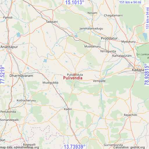
Pulivendla GPS coordinates[2]
14° 25' 17.004" North, 78° 13' 30.072" East
| Map corner | latitude | longitude |
|---|---|---|
| Upper-left | 15.1013°, | 77.5219° |
| Center: | 14.42139°, | 78.22502° |
| Lower-right: | 13.73939°, | 78.92815° |
| Map W x H: | 151.4×151.4 km | = 94.1×94.1mi |
| max Lat: | 34.9274° ⇑82.6% North |
| Pulivendla: | 14.42139° |
| min Lat: | ⇓17.4% South 8.09008° |
| min Long | Pulivendla | max Long |
| 68.82655° | 78.22502° | 96.81° |
| W 51.4%⇐ | ⇒48.6% E |
Elevation
Elevation of Pulivendla is 273 m = 896 ft, and this is 22.6 m = 74 ft below average elevation for this country.
| Max E: |
3681 m = 12077 ft | 36.8% |
| Avg. | 295.6 m = 970 ft | |
| Pulivendla | 273 m = 896 ft | |
Min E: |
1 m = 3 ft | 63.2% |
See also: India elevation on elevation.city.
Geographical zone
Pulivendla is located in North Torrid zone (between Equator and Tropic of Cancer). Distance of this Northern Tropic circle is 1002.4 km =622.9 mi to North.| Distance of | km | miles | from Pulivendla |
|---|---|---|---|
| North Pole | 8403.6 | 5221.8 | to North |
| Arctic Circle | 5797.7 | 3602.5 | to North |
| Tropic Cancer | 1002.4 | 622.9 | to North |
| Equator | 1603.5 | 996.4 | to South |


Nearby cities:
15 places around Pulivendla: (largest is in red/bold)
• Anantapur
72.3 km =44.9 mi,  293°
293°
• Bāgepalli
84.7 km =52.6 mi,  213°
213°
• Chinnachowk
66 km =41 mi,  84°
84°
• Cuddapah
64.8 km =40.3 mi, 84°
• Dharmavaram
54.4 km =33.8 mi,  269°
269°
• Erraguntla
41.6 km =25.8 mi,  54°
54°
• Gorantla
68.9 km =42.8 mi,  225°
225°
• Jammalamadugu
50.3 km =31.3 mi,  19°
19°
• Kadiri
35.1 km =21.8 mi,  191°
191°
• Kāmalāpuram
51.7 km =32.1 mi,  67°
67°
• Penukonda
77.7 km =48.3 mi,  241°
241°
• Proddatūr
50.5 km =31.4 mi,  43°
43°
• Puttaparthi
52.9 km =32.9 mi, 237°
• Rāyachoti
69.6 km =43.2 mi,  125°
125°
• Tādpatri
58.9 km =36.6 mi,  336°
336°
Sources, notices
• [Note1] Compared only with cities in India existing in our database
• [Src1] Map data: © OpenStreetMap contributors (CC-BY-SA)
• [Src2] Other city data from geonames.org with taken over terms of usage.
• [Src3] Geographical zone / Annual Mean Temperature by Robert A. Rohde @ Wikipedia
