Nīmāj geodata
Nīmāj (Rajasthan) is a populated place; located in India in Asia/Kolkata (GMT+5.5) time zone. With population of 20,424 people, there are 2007 cities with bigger population in this country. Compared to other cities in India, 71.5% of cities are located further ↓South; 89.4% of cities are located further →East and 68.9% of cities have lower elevation than Nīmāj. Note1


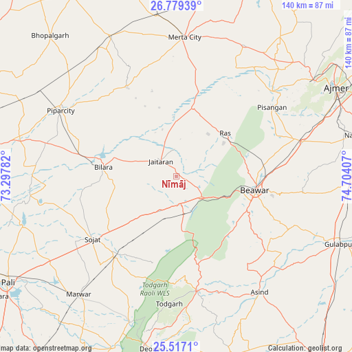
Nīmāj GPS coordinates[2]
26° 8' 59.82" North, 74° 0' 3.384" East
| Map corner | latitude | longitude |
|---|---|---|
| Upper-left | 26.77939°, | 73.29782° |
| Center: | 26.14995°, | 74.00094° |
| Lower-right: | 25.5171°, | 74.70407° |
| Map W x H: | 140.4×140.4 km | = 87.2×87.2mi |
| max Lat: | 34.9274° ⇑28.5% North |
| Nīmāj: | 26.14995° |
| min Lat: | ⇓71.5% South 8.09008° |
| min Long | Nīmāj | max Long |
| 68.82655° | 74.00094° | 96.81° |
| W 10.6%⇐ | ⇒89.4% E |
Elevation
Elevation of Nīmāj is 316 m = 1037 ft, and this is 20.4 m = 67 ft above average elevation for this country.
| Max E: |
3681 m = 12077 ft | 31.1% |
| Nīmāj | 316 m 1037 ft | |
| Avg. | 295.6 m = 970 ft | |
Min E: |
1 m = 3 ft | 68.9% |
See also: India elevation on elevation.city.
Geographical zone
Nīmāj is located in North temperate zone (between Tropic of Cancer and the Arctic Circle). Distance of this Northern Tropic circle is 301.7 km =187.5 mi to South.| Distance of | km | miles | from Nīmāj |
|---|---|---|---|
| North Pole | 7099.5 | 4411.4 | to North |
| Arctic Circle | 4493.6 | 2792.2 | to North |
| Tropic Cancer | 301.7 | 187.5 | to South |
| Equator | 2907.6 | 1806.7 | to South |


Nearby cities:
15 places around Nīmāj: (largest is in red/bold)
• Ajmer
71.9 km =44.7 mi,  62°
62°
• Beāwar
32.3 km =20.1 mi,  99°
99°
• Bilāra
29.7 km =18.5 mi,  276°
276°
• Devgarh
70.1 km =43.6 mi,  187°
187°
• Gulābpura
71.3 km =44.3 mi,  112°
112°
• Jaitāran
8.8 km =5.5 mi,  313°
313°
• Kuchera
93.2 km =57.9 mi,  358°
358°
• Merta
55.5 km =34.5 mi,  3°
3°
• Nasīrābād
75.1 km =46.7 mi,  76°
76°
• Pushkar
66.7 km =41.4 mi, 55°
• Pāli
79.7 km =49.5 mi,  238°
238°
• Pīpār
52.5 km =32.6 mi,  299°
299°
• Raipur
12.2 km =7.6 mi,  169°
169°
• Sojat
41.8 km =26 mi,  233°
233°
• Āsind
56.9 km =35.4 mi,  144°
144°
Sources, notices
• [Note1] Compared only with cities in India existing in our database
• [Src1] Map data: © OpenStreetMap contributors (CC-BY-SA)
• [Src2] Other city data from geonames.org with taken over terms of usage.
• [Src3] Geographical zone / Annual Mean Temperature by Robert A. Rohde @ Wikipedia
