Narsinghgarh geodata
Narsinghgarh (Madhya Pradesh) is a populated place; located in India in Asia/Kolkata (GMT+5.5) time zone. With population of 29,981 people, there are 1446 cities with bigger population in this country. Compared to other cities in India, 56.1% of cities are located further ↓South; 62.1% of cities are located further →East and 80.1% of cities have lower elevation than Narsinghgarh. Note1


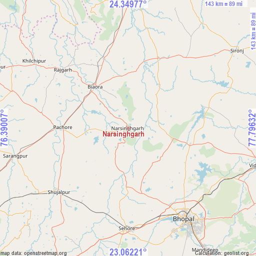
Narsinghgarh GPS coordinates[2]
23° 42' 27.288" North, 77° 5' 35.484" East
| Map corner | latitude | longitude |
|---|---|---|
| Upper-left | 24.34977°, | 76.39007° |
| Center: | 23.70758°, | 77.09319° |
| Lower-right: | 23.06221°, | 77.79632° |
| Map W x H: | 143.2×143.2 km | = 89×89mi |
| max Lat: | 34.9274° ⇑43.9% North |
| Narsinghgarh: | 23.70758° |
| min Lat: | ⇓56.1% South 8.09008° |
| min Long | Narsinghgarh | max Long |
| 68.82655° | 77.09319° | 96.81° |
| W 37.9%⇐ | ⇒62.1% E |
Elevation
Elevation of Narsinghgarh is 461 m = 1512 ft, and this is 165.4 m = 543 ft above average elevation for this country.
| Max E: |
3681 m = 12077 ft | 19.9% |
| Narsinghgarh | 461 m 1512 ft | |
| Avg. | 295.6 m = 970 ft | |
Min E: |
1 m = 3 ft | 80.1% |
See also: India elevation on elevation.city.
Geographical zone
Narsinghgarh is located in North temperate zone (between Tropic of Cancer and the Arctic Circle). Distance of this Northern Tropic circle is 30.1 km =18.7 mi to South.| Distance of | km | miles | from Narsinghgarh |
|---|---|---|---|
| North Pole | 7371 | 4580.1 | to North |
| Arctic Circle | 4765.1 | 2960.9 | to North |
| Tropic Cancer | 30.1 | 18.7 | to South |
| Equator | 2636 | 1637.9 | to South |


Nearby cities:
15 places around Narsinghgarh: (largest is in red/bold)
• Akodia
62.2 km =38.6 mi,  234°
234°
• Berasia
35.7 km =22.2 mi,  103°
103°
• Bhopal
59.4 km =36.9 mi,  147°
147°
• Biaora
30.1 km =18.7 mi,  321°
321°
• Chandpura
26.3 km =16.3 mi,  52°
52°
• Garha Brahman
32.3 km =20.1 mi,  56°
56°
• Khata Khedi
27.1 km =16.8 mi, 47°
• Khilchipur
64.1 km =39.8 mi,  305°
305°
• Khujner
49.2 km =30.6 mi,  280°
280°
• Leteri
50.6 km =31.4 mi,  39°
39°
• Patalpani
30.4 km =18.9 mi, 60°
• Rājgarh
49.6 km =30.8 mi, 312°
• Sehore
56.4 km =35 mi,  181°
181°
• Shujālpur
51.4 km =31.9 mi, 229°
• Talen
40.2 km =25 mi,  247°
247°
Sources, notices
• [Note1] Compared only with cities in India existing in our database
• [Src1] Map data: © OpenStreetMap contributors (CC-BY-SA)
• [Src2] Other city data from geonames.org with taken over terms of usage.
• [Src3] Geographical zone / Annual Mean Temperature by Robert A. Rohde @ Wikipedia
