Khujner geodata
Khujner (Madhya Pradesh) is a populated place; located in India in Asia/Kolkata (GMT+5.5) time zone. With population of 9,950 people, there are 2952 cities with bigger population in this country. Compared to other cities in India, 56.7% of cities are located further ↓South; 67.1% of cities are located further →East and 78.7% of cities have lower elevation than Khujner. Note1


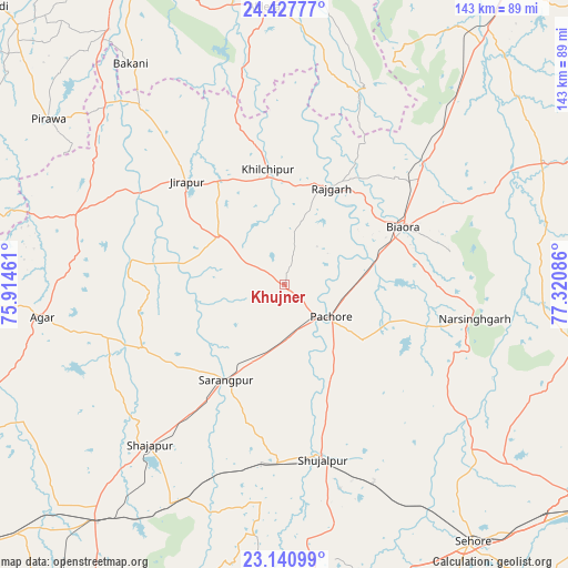
Khujner GPS coordinates[2]
23° 47' 9.492" North, 76° 37' 3.828" East
| Map corner | latitude | longitude |
|---|---|---|
| Upper-left | 24.42777°, | 75.91461° |
| Center: | 23.78597°, | 76.61773° |
| Lower-right: | 23.14099°, | 77.32086° |
| Map W x H: | 143.1×143.1 km | = 88.9×88.9mi |
| max Lat: | 34.9274° ⇑43.3% North |
| Khujner: | 23.78597° |
| min Lat: | ⇓56.7% South 8.09008° |
| min Long | Khujner | max Long |
| 68.82655° | 76.61773° | 96.81° |
| W 32.9%⇐ | ⇒67.1% E |
Elevation
Elevation of Khujner is 442 m = 1450 ft, and this is 146.4 m = 480 ft above average elevation for this country.
| Max E: |
3681 m = 12077 ft | 21.3% |
| Khujner | 442 m 1450 ft | |
| Avg. | 295.6 m = 970 ft | |
Min E: |
1 m = 3 ft | 78.7% |
See also: India elevation on elevation.city.
Geographical zone
Khujner is located in North temperate zone (between Tropic of Cancer and the Arctic Circle). Distance of this Northern Tropic circle is 38.8 km =24.1 mi to South.| Distance of | km | miles | from Khujner |
|---|---|---|---|
| North Pole | 7362.3 | 4574.7 | to North |
| Arctic Circle | 4756.4 | 2955.5 | to North |
| Tropic Cancer | 38.8 | 24.1 | to South |
| Equator | 2644.8 | 1643.4 | to South |


Nearby cities:
15 places around Khujner: (largest is in red/bold)
• Agar
61.8 km =38.4 mi,  262°
262°
• Akodia
45.2 km =28.1 mi,  182°
182°
• Bakāni
67.7 km =42.1 mi,  325°
325°
• Biaora
33.3 km =20.7 mi,  63°
63°
• Khata Khedi
69 km =42.9 mi,  82°
82°
• Khilchipur
28.5 km =17.7 mi,  351°
351°
• Manohar Thāna
53.8 km =33.4 mi,  20°
20°
• Māchalpur
48.8 km =30.3 mi,  321°
321°
• Narsinghgarh
49.2 km =30.6 mi,  100°
100°
• Rājgarh
27.3 km =17 mi,  25°
25°
• Shujālpur
43.2 km =26.8 mi,  167°
167°
• Shājāpur
52.9 km =32.9 mi,  220°
220°
• Susner
56.7 km =35.2 mi,  288°
288°
• Sārangpur
28.5 km =17.7 mi,  211°
211°
• Talen
26.6 km =16.5 mi,  154°
154°
Sources, notices
• [Note1] Compared only with cities in India existing in our database
• [Src1] Map data: © OpenStreetMap contributors (CC-BY-SA)
• [Src2] Other city data from geonames.org with taken over terms of usage.
• [Src3] Geographical zone / Annual Mean Temperature by Robert A. Rohde @ Wikipedia
