Nārnaund geodata
Nārnaund (Haryana) is a populated place; located in India in Asia/Kolkata (GMT+5.5) time zone. With population of 16,299 people, there are 2347 cities with bigger population in this country. Compared to other cities in India, 89.9% of cities are located further ↓South; 72.2% of cities are located further →East and 56.1% of cities have lower elevation than Nārnaund. Note1


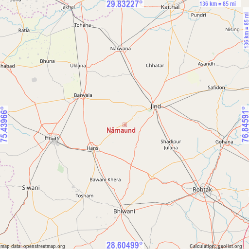
Nārnaund GPS coordinates[2]
29° 13' 13.692" North, 76° 8' 34.008" East
| Map corner | latitude | longitude |
|---|---|---|
| Upper-left | 29.83227°, | 75.43966° |
| Center: | 29.22047°, | 76.14278° |
| Lower-right: | 28.60499°, | 76.84591° |
| Map W x H: | 136.5×136.5 km | = 84.8×84.8mi |
| max Lat: | 34.9274° ⇑10.1% North |
| Nārnaund: | 29.22047° |
| min Lat: | ⇓89.9% South 8.09008° |
| min Long | Nārnaund | max Long |
| 68.82655° | 76.14278° | 96.81° |
| W 27.8%⇐ | ⇒72.2% E |
Elevation
Elevation of Nārnaund is 230 m = 755 ft, and this is 65.6 m = 215 ft below average elevation for this country.
| Max E: |
3681 m = 12077 ft | 43.9% |
| Avg. | 295.6 m = 970 ft | |
| Nārnaund | 230 m = 755 ft | |
Min E: |
1 m = 3 ft | 56.1% |
See also: India elevation on elevation.city.
Geographical zone
Nārnaund is located in North temperate zone (between Tropic of Cancer and the Arctic Circle). Distance of this Northern Tropic circle is 643.1 km =399.6 mi to South.| Distance of | km | miles | from Nārnaund |
|---|---|---|---|
| North Pole | 6758.1 | 4199.3 | to North |
| Arctic Circle | 4152.2 | 2580.1 | to North |
| Tropic Cancer | 643.1 | 399.6 | to South |
| Equator | 3249 | 2018.8 | to South |


Nearby cities:
15 places around Nārnaund: (largest is in red/bold)
• Bara Uchāna
27.7 km =17.2 mi,  7°
7°
• Barwāla
28 km =17.4 mi,  305°
305°
• Bhiwāni
47.5 km =29.5 mi,  180°
180°
• Gohāna
55.1 km =34.2 mi,  99°
99°
• Gorakhpur
52.2 km =32.4 mi,  298°
298°
• Hisar
41.4 km =25.7 mi,  259°
259°
• Hānsi
21.9 km =13.6 mi,  233°
233°
• Jīnd
19.8 km =12.3 mi,  57°
57°
• Kalānaur
50.1 km =31.1 mi,  150°
150°
• Maham
31.6 km =19.6 mi, 152°
• Narwāna
42.2 km =26.2 mi,  356°
356°
• Safidon
55.2 km =34.3 mi,  68°
68°
• Shādīpur Julāna
27.7 km =17.2 mi,  112°
112°
• Toshām
44.8 km =27.8 mi,  209°
209°
• Uklāna
41.3 km =25.7 mi,  321°
321°
Sources, notices
• [Note1] Compared only with cities in India existing in our database
• [Src1] Map data: © OpenStreetMap contributors (CC-BY-SA)
• [Src2] Other city data from geonames.org with taken over terms of usage.
• [Src3] Geographical zone / Annual Mean Temperature by Robert A. Rohde @ Wikipedia
