Bastī geodata
Bastī (Uttar Pradesh) is a populated place; located in India in Asia/Kolkata (GMT+5.5) time zone. With population of 115,115 people, there are 384 cities with bigger population in this country. Compared to other cities in India, 76.8% of cities are located further ↓South; 78.6% of cities are located further ←West and 69.9% of cities have higher elevation than Bastī. Note1


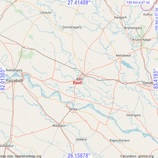
Bastī GPS coordinates[2]
26° 47' 17.412" North, 82° 42' 58.212" East
| Map corner | latitude | longitude |
|---|---|---|
| Upper-left | 27.41409°, | 82.01305° |
| Center: | 26.78817°, | 82.71617° |
| Lower-right: | 26.15878°, | 83.4193° |
| Map W x H: | 139.6×139.6 km | = 86.7×86.7mi |
| max Lat: | 34.9274° ⇑23.2% North |
| Bastī: | 26.78817° |
| min Lat: | ⇓76.8% South 8.09008° |
| min Long | Bastī | max Long |
| 68.82655° | 82.71617° | 96.81° |
| W 78.6%⇐ | ⇒21.4% E |
Elevation
Elevation of Bastī is 92 m = 302 ft, and this is 203.6 m = 668 ft below average elevation for this country.
| Max E: |
3681 m = 12077 ft | 69.9% |
| Avg. | 295.6 m = 970 ft | |
| Bastī | 92 m = 302 ft | |
Min E: |
1 m = 3 ft | 30.1% |
See also: Bastī elevation on elevation.city.
Geographical zone
Bastī is located in North temperate zone (between Tropic of Cancer and the Arctic Circle). Distance of this Northern Tropic circle is 372.6 km =231.5 mi to South.| Distance of | km | miles | from Bastī |
|---|---|---|---|
| North Pole | 7028.5 | 4367.3 | to North |
| Arctic Circle | 4422.6 | 2748.1 | to North |
| Tropic Cancer | 372.6 | 231.5 | to South |
| Equator | 2978.6 | 1850.8 | to South |


Nearby cities:
15 places around Bastī: (largest is in red/bold)
• Ajodhya
50.8 km =31.6 mi,  271°
271°
• Akbarpur
43.8 km =27.2 mi,  204°
204°
• Atraulia
55.6 km =34.5 mi,  155°
155°
• Bānsi
48.4 km =30.1 mi,  26°
26°
• Bīkāpur
61.8 km =38.4 mi,  249°
249°
• Fyzābād
56.2 km =34.9 mi, 268°
• Goshāinganj
41.1 km =25.5 mi,  234°
234°
• Haraiya
25 km =15.5 mi, 271°
• Jalālpur
53 km =32.9 mi,  177°
177°
• Khalīlābād
35.3 km =21.9 mi,  92°
92°
• Maghar
41 km =25.5 mi,  95°
95°
• Mankāpur
56.5 km =35.1 mi,  301°
301°
• Mehndāwal
44.3 km =27.5 mi,  61°
61°
• Nawābganj
57.7 km =35.9 mi,  278°
278°
• Tāndā
27.1 km =16.8 mi,  192°
192°
Sources, notices
• [Note1] Compared only with cities in India existing in our database
• [Src1] Map data: © OpenStreetMap contributors (CC-BY-SA)
• [Src2] Other city data from geonames.org with taken over terms of usage.
• [Src3] Geographical zone / Annual Mean Temperature by Robert A. Rohde @ Wikipedia
