Medak geodata
Medak (Telangana) is a populated place; located in India in Asia/Kolkata (GMT+5.5) time zone. With population of 44,351 people, there are 997 cities with bigger population in this country. Compared to other cities in India, 71.7% of cities are located further ↑North; 51.9% of cities are located further ←West and 81.1% of cities have lower elevation than Medak. Note1


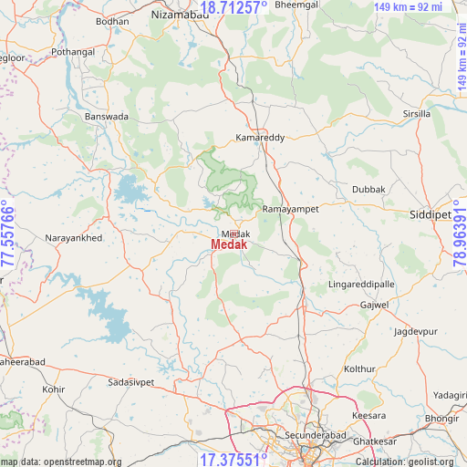
Medak GPS coordinates[2]
18° 2' 43.116" North, 78° 15' 38.808" East
| Map corner | latitude | longitude |
|---|---|---|
| Upper-left | 18.71257°, | 77.55766° |
| Center: | 18.04531°, | 78.26078° |
| Lower-right: | 17.37551°, | 78.96391° |
| Map W x H: | 148.7×148.7 km | = 92.4×92.4mi |
| max Lat: | 34.9274° ⇑71.7% North |
| Medak: | 18.04531° |
| min Lat: | ⇓28.3% South 8.09008° |
| min Long | Medak | max Long |
| 68.82655° | 78.26078° | 96.81° |
| W 51.9%⇐ | ⇒48.1% E |
Elevation
Elevation of Medak is 474 m = 1555 ft, and this is 178.4 m = 585 ft above average elevation for this country.
| Max E: |
3681 m = 12077 ft | 18.9% |
| Medak | 474 m 1555 ft | |
| Avg. | 295.6 m = 970 ft | |
Min E: |
1 m = 3 ft | 81.1% |
See also: Medak elevation on elevation.city.
Geographical zone
Medak is located in North Torrid zone (between Equator and Tropic of Cancer). Distance of this Northern Tropic circle is 599.5 km =372.5 mi to North.| Distance of | km | miles | from Medak |
|---|---|---|---|
| North Pole | 8000.6 | 4971.3 | to North |
| Arctic Circle | 5394.7 | 3352.1 | to North |
| Tropic Cancer | 599.5 | 372.5 | to North |
| Equator | 2006.5 | 1246.8 | to South |


Nearby cities:
15 places around Medak: (largest is in red/bold)
• Andol
32.2 km =20 mi,  217°
217°
• Bānswāda
54.6 km =33.9 mi,  312°
312°
• Chandūr
25.5 km =15.8 mi, 221°
• Kāmāreddi
31.7 km =19.7 mi,  15°
15°
• Kūkatpalli
64.4 km =40 mi,  165°
165°
• Medchal
51.8 km =32.2 mi,  153°
153°
• Nārsingi
17.4 km =10.8 mi,  90°
90°
• Patancheru
56.9 km =35.4 mi,  179°
179°
• Quthbullapur
64 km =39.8 mi,  160°
160°
• Sadāseopet
57.5 km =35.7 mi,  214°
214°
• Sangāreddi
50.3 km =31.3 mi,  201°
201°
• Secunderabad
67.2 km =41.8 mi, 153°
• Serilingampalle
61.6 km =38.3 mi, 175°
• Siddipet
62.5 km =38.8 mi,  83°
83°
• Singāpur
65.6 km =40.8 mi,  192°
192°
Sources, notices
• [Note1] Compared only with cities in India existing in our database
• [Src1] Map data: © OpenStreetMap contributors (CC-BY-SA)
• [Src2] Other city data from geonames.org with taken over terms of usage.
• [Src3] Geographical zone / Annual Mean Temperature by Robert A. Rohde @ Wikipedia
