Chandūr geodata
Chandūr (Telangana) is a populated place; located in India in Asia/Kolkata (GMT+5.5) time zone. With population of 11,220 people, there are 2809 cities with bigger population in this country. Compared to other cities in India, 72.1% of cities are located further ↑North; 50.1% of cities are located further →East and 82.7% of cities have lower elevation than Chandūr. Note1


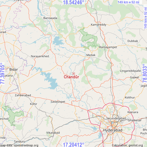
Chandūr GPS coordinates[2]
17° 52' 28.38" North, 78° 6' 0.612" East
| Map corner | latitude | longitude |
|---|---|---|
| Upper-left | 18.54246°, | 77.39705° |
| Center: | 17.87455°, | 78.10017° |
| Lower-right: | 17.20412°, | 78.8033° |
| Map W x H: | 148.8×148.8 km | = 92.5×92.5mi |
| max Lat: | 34.9274° ⇑72.1% North |
| Chandūr: | 17.87455° |
| min Lat: | ⇓27.9% South 8.09008° |
| min Long | Chandūr | max Long |
| 68.82655° | 78.10017° | 96.81° |
| W 49.9%⇐ | ⇒50.1% E |
Elevation
Elevation of Chandūr is 503 m = 1650 ft, and this is 207.4 m = 680 ft above average elevation for this country.
| Max E: |
3681 m = 12077 ft | 17.3% |
| Chandūr | 503 m 1650 ft | |
| Avg. | 295.6 m = 970 ft | |
Min E: |
1 m = 3 ft | 82.7% |
See also: India elevation on elevation.city.
Geographical zone
Chandūr is located in North Torrid zone (between Equator and Tropic of Cancer). Distance of this Northern Tropic circle is 618.5 km =384.3 mi to North.| Distance of | km | miles | from Chandūr |
|---|---|---|---|
| North Pole | 8019.6 | 4983.1 | to North |
| Arctic Circle | 5413.7 | 3363.9 | to North |
| Tropic Cancer | 618.5 | 384.3 | to North |
| Equator | 1987.5 | 1235 | to South |


Nearby cities:
15 places around Chandūr: (largest is in red/bold)
• Andol
7.1 km =4.4 mi,  200°
200°
• Bānswāda
60.5 km =37.6 mi,  337°
337°
• Bīdar
60.5 km =37.6 mi,  274°
274°
• Kāmāreddi
55.7 km =34.6 mi,  27°
27°
• Kūkatpalli
54.6 km =33.9 mi,  142°
142°
• Medak
25.5 km =15.8 mi,  41°
41°
• Medchal
48.7 km =30.3 mi,  123°
123°
• Nārsingi
39.2 km =24.4 mi,  61°
61°
• Patancheru
41.7 km =25.9 mi,  155°
155°
• Quthbullapur
56.2 km =34.9 mi, 137°
• Sadāseopet
32.4 km =20.1 mi,  208°
208°
• Sangāreddi
27.8 km =17.3 mi,  182°
182°
• Serilingampalle
47.5 km =29.5 mi,  153°
153°
• Singāpur
45.1 km =28 mi, 176°
• Zahirābād
56.4 km =35 mi,  247°
247°
Sources, notices
• [Note1] Compared only with cities in India existing in our database
• [Src1] Map data: © OpenStreetMap contributors (CC-BY-SA)
• [Src2] Other city data from geonames.org with taken over terms of usage.
• [Src3] Geographical zone / Annual Mean Temperature by Robert A. Rohde @ Wikipedia
