Būndi geodata
Būndi (Rajasthan) is a populated place; located in India in Asia/Kolkata (GMT+5.5) time zone. With population of 98,569 people, there are 448 cities with bigger population in this country. Compared to other cities in India, 66.4% of cities are located further ↓South; 77.2% of cities are located further →East and 63.4% of cities have lower elevation than Būndi. Note1


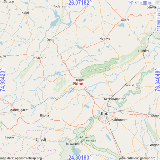
Būndi GPS coordinates[2]
25° 26' 18.78" North, 75° 38' 14.46" East
| Map corner | latitude | longitude |
|---|---|---|
| Upper-left | 26.07182°, | 74.93423° |
| Center: | 25.43855°, | 75.63735° |
| Lower-right: | 24.80193°, | 76.34048° |
| Map W x H: | 141.2×141.2 km | = 87.7×87.7mi |
| max Lat: | 34.9274° ⇑33.6% North |
| Būndi: | 25.43855° |
| min Lat: | ⇓66.4% South 8.09008° |
| min Long | Būndi | max Long |
| 68.82655° | 75.63735° | 96.81° |
| W 22.8%⇐ | ⇒77.2% E |
Elevation
Elevation of Būndi is 274 m = 899 ft, and this is 21.6 m = 71 ft below average elevation for this country.
| Max E: |
3681 m = 12077 ft | 36.6% |
| Avg. | 295.6 m = 970 ft | |
| Būndi | 274 m = 899 ft | |
Min E: |
1 m = 3 ft | 63.4% |
See also: Būndi elevation on elevation.city.
Geographical zone
Būndi is located in North temperate zone (between Tropic of Cancer and the Arctic Circle). Distance of this Northern Tropic circle is 222.6 km =138.3 mi to South.| Distance of | km | miles | from Būndi |
|---|---|---|---|
| North Pole | 7178.6 | 4460.6 | to North |
| Arctic Circle | 4572.7 | 2841.3 | to North |
| Tropic Cancer | 222.6 | 138.3 | to South |
| Equator | 2828.5 | 1757.5 | to South |


Nearby cities:
15 places around Būndi: (largest is in red/bold)
• Anta
73.9 km =45.9 mi,  115°
115°
• Borkhera
9.2 km =5.7 mi,  1°
1°
• Deoli
43.8 km =27.2 mi,  323°
323°
• Jahāzpur
41.5 km =25.8 mi,  299°
299°
• Kekri
76.8 km =47.7 mi, 320°
• Keshorai Pātan
34.4 km =21.4 mi, 118°
• Kota
34.9 km =21.7 mi,  144°
144°
• Kāpren
44 km =27.3 mi,  94°
94°
• Lākheri
60 km =37.3 mi,  64°
64°
• Māndalgarh
63 km =39.1 mi,  244°
244°
• Nainwa
42.7 km =26.5 mi,  29°
29°
• Rāwatbhāta
56.7 km =35.2 mi,  184°
184°
• Shāhpura
74.3 km =46.2 mi,  285°
285°
• Singoli
62.5 km =38.8 mi,  212°
212°
• Todaraisingh
66.9 km =41.6 mi,  346°
346°
Sources, notices
• [Note1] Compared only with cities in India existing in our database
• [Src1] Map data: © OpenStreetMap contributors (CC-BY-SA)
• [Src2] Other city data from geonames.org with taken over terms of usage.
• [Src3] Geographical zone / Annual Mean Temperature by Robert A. Rohde @ Wikipedia
